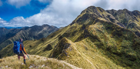
Contemplating the steep craggy route on the north side of Bannister
Since August I’d been watching for a two day weather window, which finally came just pre Christmas. Now I enjoyed excellent conditions all to myself on the tops, while also discovering just how big, as an overnighter at least, my objective was. If I’d pushed on in August, alone as I was, it would have certainly been too much. This time, to avoid the ‘worst trail’ – a section shown on the map skirting around a valley wall at about 800 metres between Cow Creek Hut and Arete Forks Hut, I’d planned to access the tops via Cow Saddle (670m), go all the way around to Lancaster (1,504), which would give me all fifteen high points, after having passed over Bannister’s low (1,513m) and high (1,537m) peaks and Arete (1,505m) on the way. Then I could just retrace my steps. No worries. Wrong!
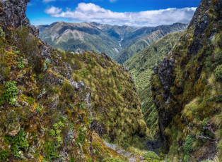
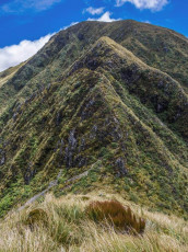
It’s all too easy to under estimate the Tararuas. Sadly, most years people pay the ultimate price for doing this. While they don’t break 1,600 metres anywhere along their length, the Tararuas are a complex network of exposed ridges and deep rugged river valleys. Between the tops and the rivers, often on very steep hillsides, is dense forest, slippery gravel, roots and mud. It rains and blows - a lot. It’s not civilised, even when sticking like glue, as I do, to DoCs little orange triangles. And, once free of the bush, along the tops it can be surprisingly craggy, steep and narrow, as I discovered north of Bannister’s low peak. Here, on a small near vertical section only a few metres high, as I climbed, groping for fewer hand and footholds than my comfort zone required, I realised that the exposure and lack of a companion meant that I didn’t want to climb back down this way.
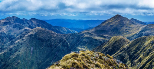
Bannister summit (1,537m) view south west to Lancaster (1,504 - left), Arete Bivy (1,360m - right of centre), the Twins (1,466m and 1,440m - right foreground) and Arete (1,505m - right skyline).
There was also another aspect I’d under estimated – the time needed to cover my route. To access the tops I first had to climb from Kiriwhakapapa campsite at the road end, up over the Blue Range. This requires about 800 metres of up and then 600 metres of down to Cow Creek Hut – a bit under four hours walking on the way in and an hour more on the way out due to the rigors my legs endured in between. From Cow Creek the going gets tougher as the real climb begins, first to Cow Saddle, then up a steep ridge on to the tops and Waingawa Peak (1,423m). A heap of storm damage between about 700 and 850 metres made this section extra hard going. There is a shortcut to Cow Saddle at the western end of the Blue Range track that avoids some of the descent all the way to Cow Creek Hut but, after following it for a bit, it dissolved into a labyrinth of goblin forest on a broad ridge, so I opted for the security of the orange triangles back on the main trail.
For me, the most challenging scrambling was south of Waingawa on the approach to Bannister. But there are plenty of other sections along this route that demand care and concentration. And there are many, many ups and downs. In the course of my two days I was on the move for 25 hours and ascended and descended at least 3,500 metres. By comparison, my climb of Aoraki Mount Cook a few years ago, from Plateau Hut via the Linda Glacier, took 14 hours and 1,700 metres of ascent/descent – so height above sea level is definitely not the only way to define a big day out. There are plenty of them lurking in the Tararuas.
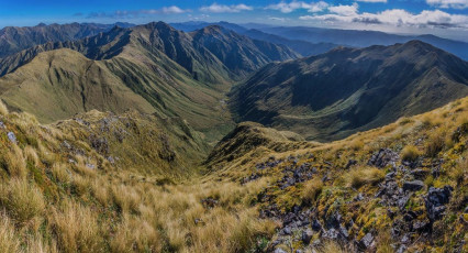
While it’s hard work along the ridge between Waingawa and Arete, the views are worth the effort. Being on some of the highest of the Tararuas’ tops, there are expansive vistas in every direction most of the time. It’s only when you get up close and personal with steep sections that they seem to disappear in favour of close-ups of the next tussock or rocky handhold. From Bannister there’s a clear view west over the Twins (1,466m and 1,440m) to Arete, Arete Bivy directly beneath and Lancaster a little further to the south. And east of Lancaster is Pinnacle Ridge, dropping steeply to Arete Forks, then leading away east around the ‘worst trail’ to Cow Creek.
Although I didn’t have to climb Arete in order to reach the bivy beneath – there’s a trail that traverses across beneath Arete, I did in order to honour my goal for the trip. By the time I’d had a photo-stop on top of Arete it was nearly 6pm, 12 hours on from when I set off from Kiriwhakapapa camp site that morning.
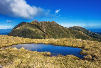
The tarn just above Arete Bivy, with Bannister and the Twins.
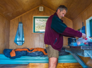
The wind had strengthened considerably, so it was a mighty pleasure to shrug off my pack on the second of the two bunks down at Arete Bivy and fire up a brew. The bivy is a little charmer and in pretty much brand spanking condition, with its own water tank and throne just a little down the tussock bench where it’s situated.
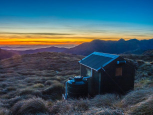
Arete Bivy – a 2 bunk charmer at 1,360m.
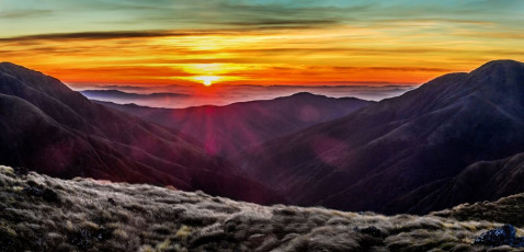
Dawn view south east from Arete Bivy to the Blue Range.
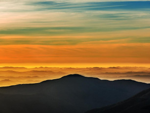
With all the wind and cloud that evening I had no sunset, but the windless sunrise next morning more than made up for it. A panorama, framed to the left by Bannister and to the right by Lancaster, takes in a sea of layered ridges stretching out across the Wairarapa. The tranquillity put me in a good frame of mind for the rigors still to come.
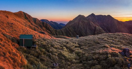
I was away by about 7am and the first stretch south to Lancaster was easy and a joy to walk in the early morning sunlight.
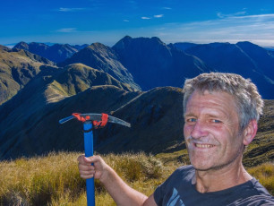
Lancaster is one of the easier 1,500 metre points to finish chasing the fifteen on, but satisfying nevertheless. Another round of summit shots captured yet more huge vistas in all directions. My immediate concern though, was not knowing just how tricky Pinnacle Ridge would be to descend.
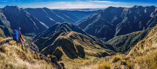
The view on the approach looked near vertical in a few places. As it turned out, the steepest section is coming directly off Pinnacle itself. The rest is not as challenging as the steep sections north of Bannister, although below the bushline, it is relentlessly, toenail destroyingly steep.
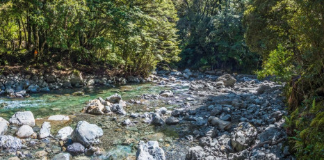
More than 800 metres below Lancaster, down at Waingawa River, wading across bare-footed to reach Arete Forks Hut soothed things down a bit after nearly four hours of toil. Now my concern was the ‘worst trail’. How tough is ‘worst’? How much storm damage?
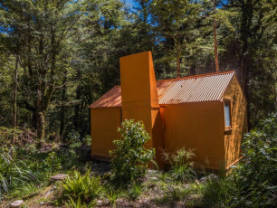
After a brew in the shade of Arete Forks Hut it was time to face the music. Into the bush and straight up. For the next four hours I descended to, then ascended from streams that have cut deep gullies into the valley wall. Six streams, six ups, six downs, adding at least 500 metres of ascent and descent. And not easy going – very steep, loose rubble, root infested and sometimes obstructed by big, shattered, storm-felled trees. Keeping on route demanded constant concentration and delays. If it had been wet I would have muttered even more four letter words than I did. ‘Worst trail in the Tararuas’? Though not having trodden all of them, I can believe it!
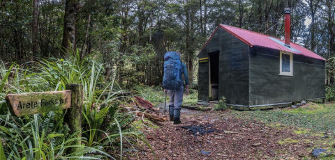
I was relieved to reach Cow Creek Hut, where I knew that all that now remained was a four or so hour slog back up over Blue Range to my car.
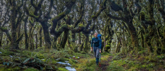
Goblin forest at about 900m on the Blue Range trail.
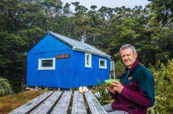
Near the top of Blue Range I met the only people I encountered during the two days. They probably wondered why I plodded up the ridge like a poorly oiled, battery depleted robot. It had been a big two days, befitting the effort needed to reach the fifteen 1,500ers of the Tararuas. End result - stuffed, but happy.


