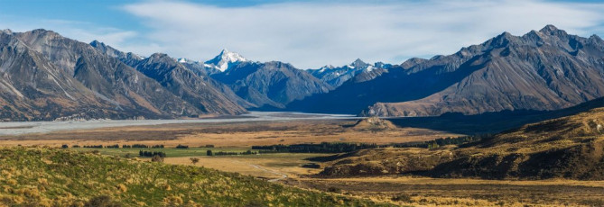
Our dawn departure from Christchurch in James’ Landcruiser was timed so we could reach our bivvy beneath Cloudy Peak before nightfall. About two hours’ drive got us to Erewhon Station, located in magnificent high country, also at the site of Edoras (of Lord of the Rings fame). From there James’ unfeasibly chunky tyres came into their own as we jolted our way across the mouth of the Clyde River into the Havelock. Due to the need to route find on our first foray this way, it took about an hour to reach our parking point. James doesn’t muck about though, so our return two days later only took half an hour. This image - on the approach to Erewhon Station.
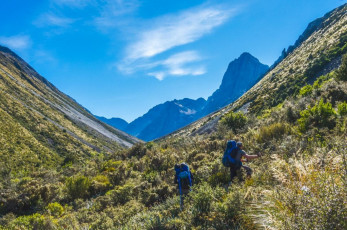
Going by the map, reaching Cloudy Peak looks like just a short scramble up Cloudy Stream, gaining about 600 metres. But maps can be deceiving. In reality, access to the stream bed is via a shelf on the true left of the stream. This takes you up through tussock to about 900 metres, at which point you could be forgiven for thinking that another hour or so of easy hiking will see you at the bivvy.
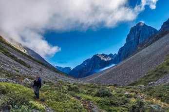
Wrong – surprise number one. It’s at this point, as you swing round into the valley that the going becomes more unruly. For the next three hours we shoved and stumbled through thick scrub and Manuka and across boulder fields, all the while trying to stick to some trace of a route, which is scanty to say the least. This image - in the scrub, Cloudy Peak is right
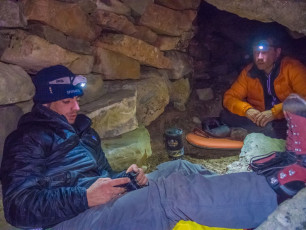
Eventually we reached the bivvy at 1,280 metres, fit to house three at a squeeze, once all the Thar droppings had been excavated. Surprise number two – no water. On account of the huge boulder piles, Cloudy Stream is buried between about 1,050 and 1,400 metres.
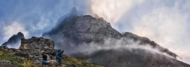
West face of Cloudy Peak, seen from our rock bivvy. The SW ridge is on the skyline, centre.
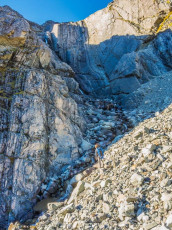
After some discussion and the drawing of straws we elected to go up further to the base of a waterfall to get our supply – easier to carry down than up and the thought of retracing our steps down through all those boulders held zero appeal. In the late afternoon light at least the view from beneath the waterfall, back down Cloudy Stream across to the Two Thumb Range, was worth the effort. This image - at our water source up valley.
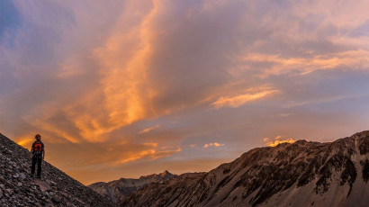
The night was crystal clear, so I elected to bivvy out, watching the stars roll by. Next morning, in still calm but clouding skies, we set off at dawn up the scree to the base of the southwest ridge at about 1,500 metres.
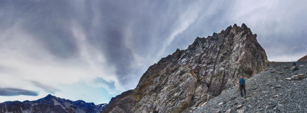
Our intended route is graded 3, 15 so, not having done much rock climbing, I was excited to see just how difficult this would be.
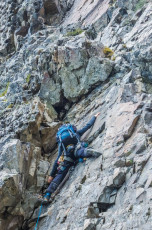
As I watched Piotr lead the first pitch up near vertical rock, battling his way around a small roof, I started to wonder if I was even going to be able to follow him with the benefit of a top rope.
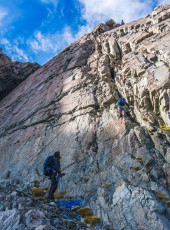
I was in good hands though, with Piotr and James alternating lead and tail end Charlie, while I struggled and cursed my way upward. To be fair, we climbed in mountain boots, not rock shoes, which certainly made things trickier. And according to Piotr and James, there were some points on the route that exceeded grade 15. Whatever the grade, it was more difficult than anything I’d previously climbed and good to know now where my limits lie.
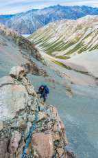
Following Piotr’s first pitch, James led on up a second steep section before we reached an exposed shoulder. Although we kept the rope on, this section was free-climbable. It led to a second near vertical section, requiring another rope length, before we reached some steep sloping scree on a ledge. Looming above was a huge wall and it wasn’t at all apparent where the southwest ridge route went next. In hindsight, we probably traversed too far left across the scree, ending up on the near vertical west face.
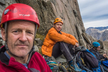
We were at 1,800 metres – only 300 metres into a 900 metre climb; and it was already after 2pm. As I munched on some lunch I pondered what Queenstown-based Dave McLeod and his climbing buddy’s had achieved many years ago on the first winter ascent of the southwest ridge. They had not only completed it in mountain boots and crampons, but also walked in and out from Erewhon Station, all in just two huge days. Respect!
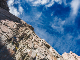
Although it now seemed likely that we’d be benighted if we continued, James was keen to keep going. So he led up a groove that seemed to have plenty of holds. This was the case, but putting in solid protection was another matter. He retreated and tried another line, running the rope up about 30 metres before Piotr and I made the call that there was no way we could reach the top before nightfall. Even then, James’ anchor placement skills were tested to place anything close to a bulletproof abseil point. By the time he re-joined us on the scree it was 4pm. This image - James on our last pitch. This face would have required at least three pitches to regain the ridgeline
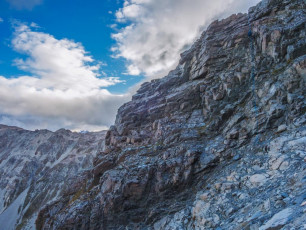
Two abseils later saw us back on the main scree fan giving access to the free-climbable east side of Cloudy Peak. Unfortunately, with less than an hour of daylight left, the 800 or so vertical metres of scrambling to the summit wasn’t on our agenda. Instead we went down, discovering a second rock bivvy only a few hundred metres from the one we were using. At dusk it started spitting, just as we neared our bivvy, confirming we’d made a sensible call. This image - James, top right, on our last abseil back to the scree fan.
Next morning we took just as long as our ascent to retrace our steps back to the Landcruiser. Now the rocks were slippery and every step was a potential injury just waiting to happen. As we went we debated about which is the best way. I’m satisfied now that staying to the true left of Cloudy Stream below about 1,000 metres is the way to go. Above that you can sidle either side of the stream, but still keeping mostly to the true left is probably best.
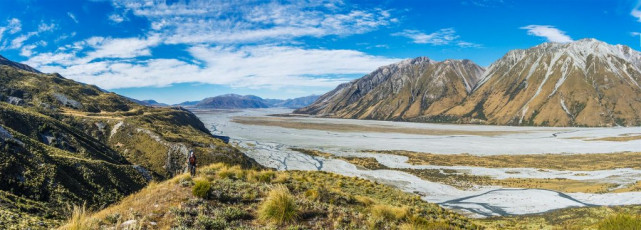
Ah well, another item on my unfinished business list. I don’t think the southwest ridge is for me, but perhaps a winter ascent via the much easier scree fan, when covered in snow during a nice bluebird weather window would be kinda nice. This image - On the bench above the Havelock River.


