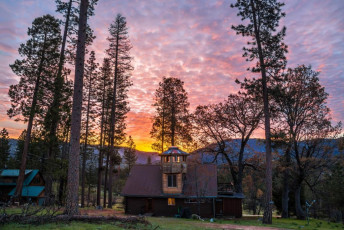
We rented a charming, spacious log cabin off Big Oak Flat Road, inside the park gates, just a ten minute drive from Yosemite Village. Ten minutes that is if the traffic doesn’t stack up. Being there in April put us outside the busy summer season, but road works still caused major jams on the single road tracing the Merced River into Yosemite Valley. I’m not a fan of crowds and, even in springtime, there were more than enough punters and their vehicles roaming the valley. I wouldn’t enjoy the congestion that must be part of a summer visit.
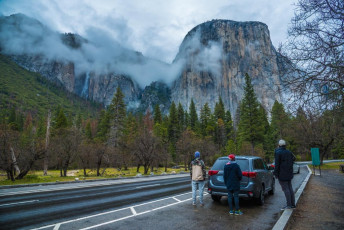
Staying inside the park gates is a good way to avoid the traffic, but accommodation is expensive – the price of fame. To keep costs down there are several camp grounds taking reservations five months out. Yosemite Valley is at about 1,200 metres though, so camping outside of summer is a chilly option. This image - in the Valley, looking up at El Capitan
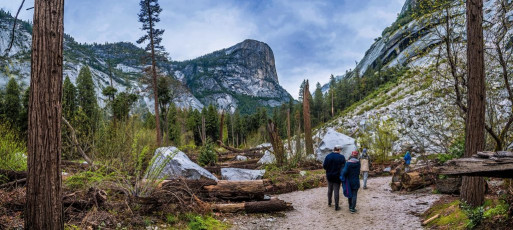
Once in the park it quickly became apparent that there are numerous beautifully formed trails leading up valley and in all directions up the steep valley walls, accessing the tops a thousand or so metres above. One of the most expansive view points, Glacier Point, can be reached by road in summer, but only via a steep climb on foot when the roads are still blocked by snow. This was the case for us, so we opted for a valley walk up under Half Dome on our first morning, with a climb to Yosemite Point on day two. This image - Beyond Mirror Lake, beneath the west face of Half Dome
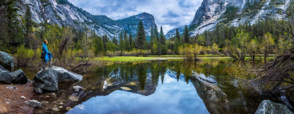
While there were lots of people milling about with their cameras near the village, it didn’t take very long to leave most of them behind on the trails. To get the most from a visit to the park definitely requires walking, though even in the valley, the views are fabulous. Imagine Milford Sound, only with a river valley where the ocean is, so you can walk beneath the sheer cliffs surrounding you. And the further you walk the more you’re rewarded with ever changing magnificence. This image - Mirror Lake, from the true right side of Tenaya Creek
On our first morning we headed up beside Tenaya Creek, which passes directly beneath the imposing western face of Half Dome. A recurring question kept popping into my mind as I developed an ever more noticeable crick in my neck from looking up – “do people REALLY climb that”. About half way along this trail we came to the Mirror Lake, reaching the true-left side first and the far true-right side on the way back. It was completely still and overcast, so the reflections were mirror perfect. It was lovely, but I think our own Lake Matheson is even more spectacular.
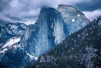
In the afternoon, after checking out the village visitor centre and the base of Yosemite Fall, we headed out of the valley and up to a carpark beside a tunnel, named unimaginatively ‘Tunnel View’. From there an hour’s climb saw us at the slightly more imaginatively named ‘Inspiration Point’. At about 1,700m we enjoyed a wide vista directly back into Yosemite Valley, taking in El Capitan, Half Dome and Bridalveil Fall. This image - Half Dome
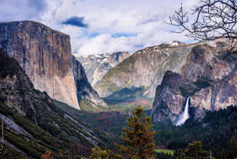
The view from Inspiration Point, with El Capitan left, Half Dome distant centre and Bridalveil Fall bottom right.
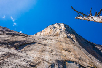
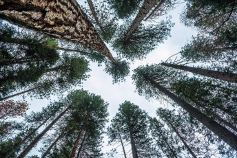
Of course, there’s more to Yosemite than spectacular views. For the serious rock climber, Yosemite is a mecca. Just scrambling up through forest to the base of El Capitan on the afternoon of our second day was enough for me. As you pop out of the trees you’re confronted with a near vertical wall of granite, soaring straight up for 1,200 metres. Feeling the quality of the rock, I could see why climbers love to get on these mammoth walls, but the level of skill required is way beyond me. From where I stood gorking skyward, a twin rope led vertically up to two climbers fifty or so metres above. Just how they got there I had no idea – the wall was so sheer and featureless. This image - A view up from the base of El Capitan
For the less ambitious, from sometime in May a steel cable is installed on the east, least steep side of Half Dome. It’s an eight or so hour day trip from the valley to then climb to the top – I guess a bit like climbing an Ayers Rock on steroids. I would like to have done that as, at 2,693m, Half Dome is the highest point in the park, offering stupendous panoramic views. As it was, we were a bit early.
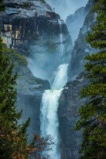
While our options were somewhat curtailed in spring, an upside was all the spectacular waterfall action going on around us. When standing in the village, the most obvious is Yosemite Fall. In spring this is a thousand metre gushing cascade with a giant step in the middle. Apparently, some summers it completely dries up.
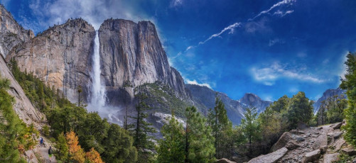
Yosemite Fall was our focus on the morning of our second day. From the valley floor a stone staircase zigzags up about 500 metres to a narrow shelf, which leads around to a mist soaked basin where the upper portion of Yosemite Fall cascades down a sheer wall. Across the valley are nice views of Half Dome, until the trail cuts up a steep chasm, seeming to almost disappear behind the Fall. Actually it pops out a little up river from the jaws of death, leading to a footbridge across Yosemite Creek which, for us, was more a raging torrent. This image - Upper Yosemite Fall and Yosemite Point (2,114m)

I’m not sure if ‘Jaws of death’ is the correct name for the point where Yosemite Creek becomes Yosemite Fall (right), but the name works for me. People, more than one, have actually been swept over it – just the thought utterly terrifies me.

Across the foot bridge we found ourselves plugging up through spring snow. Invisible down in the valley, beyond the valley rim the terrain changes dramatically into rolling, pine clad snow fields. We soon reached our high point for the day at 2,114m back on the valley rim. Here, to calm myself after gazing over the sheer edge, I worked a bit more on supersizing myself with yet another bagel (these were the best sandwich option due to American bread being pumped full of sugar). This image - The view from Yosemite Point.
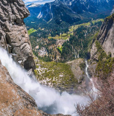
On our return we found another side trail just before the foot bridge leading right to the Jaws of Death. An easily negotiated but, at times, exposed staircase dropped down to a shelf where you can peer directly down the 500 or so metres of the upper portion of the Fall. Ooooweee. This image - Looking down upper Yosemite Fall. Part of the access trail is on the right, far below.
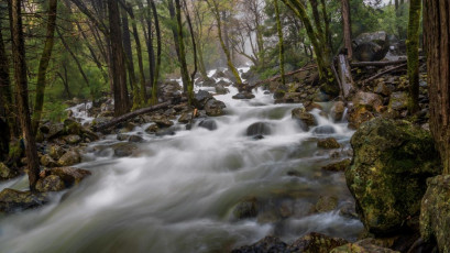
Our round trip to Yosemite Point took six and half hours so, back down on the valley floor, our time at Yosemite was running out. After paying my respects at the base of El Capitan we just had time to pop over to the base of Bridalveil Fall, another impressive gusher in springtime, where we got a good drenching. This image - the river beneath Bridalveil Fall.
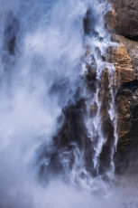
Two days at Yosemite really is the bare minimum needed to get a feel for this magnificent place. But because the trails are so numerous, well marked and well formed, it is possible to pack in quite a few different excursions in a short space of time. We saw enough at least to tell me that I need to return some day. I’d at least like to get my hands on that cable leading up the back of Half Dome and catch a sunset around at Glacier Point.


