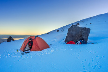
Sealed in my bivy bag, fully clothed except for my boots, with delicate pieces of my condensed and then frozen breath dropping on my face, I felt no fear. So my rapid breathing was a physical rather than emotionally driven response to my situation. But having endured it for three hours, the knowledge that I had another nine to go until dawn didn’t fill me with joy.
My two young Spanish companions, Juan and Raoul, lay shivering a few metres away in my slightly less frigid two man tent. Raoul had been a last minute addition to our party, so perhaps Juan felt a twinge of guilt that I was outside. He offered me his little travel pillow, which I gratefully accepted. In so doing I exposed my face and almost immediately my breathing settled down. Ah ha, maybe I’m susceptible to mild claustrophobia. That could explain my dislike of crowds and shopping malls. This image - Our camp (1,820m) between Tongariro and the North Crater rim, waiting for the sun to warm things up.
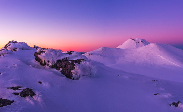
Eventually the first hint of dawn arrived and I extracted myself, somewhat stiffly, from my cocoon. From our camp we had the view point options of Tongariro’s summit (1,967m) or the slightly lower rim (1,909m) of North Crater. Having been up Tongariro several times I chose the latter. It was a relief to feel the warmth of uphill movement as I made a beeline for North Crater’s outer rim 100 metres above. My crampon spikes squeaked as they bit effortlessly into the firm snow. At last, for the first time this winter, I was blessed with perfect alpine conditions. This image -Dawn on North Crater's southern rim (1,909m). Tongariro's (1,967m) and Ngauruhoe's (2,287m) summits behind.
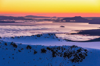
Dawn on North Crater's southern rim (1,909m), looking northwest.
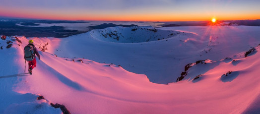
Dawn in the mountains – this is what I had primarily come for and Mother Nature didn’t disappoint. Taking in a new perspective from the southern rim of North Crater, I took photo after photo as the drama unfolded, also enjoying the gradual warmth of the new day’s first light. This image - Dawn on North Crater's southern rim (1,909m), looking north.
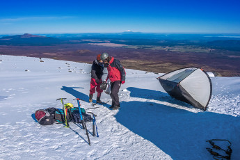
Later, back down near camp in the midst of a number two nature call a mischievous breeze suddenly blew down from the north, snatching my toilet paper roll from my hand. In my compromised squat I watched in dismay as it bounced and unrolled off down the slope. Luckily I still had the unrolled end in my grasp and, to my surprise, the eight or so metre strand didn’t snap. Like a rope I coiled it back in, stuffed most of it into my coat and completed my delicate task. Not long after, just as we’d set the main tent igloo free from its fly that breeze snuck through again and nearly carried the tent in the same direction as my toilet roll. Quick reactions just saved the day. This image - Relieved of its fly, our tent tries to make its escape in the morning breeze.
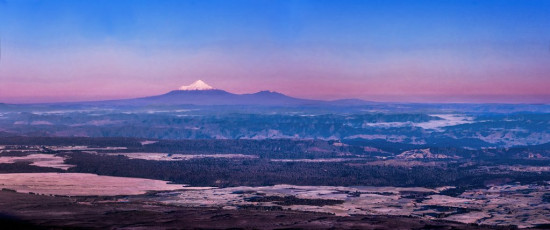
For me, the other motivation for this trip was to tread new ground on that most famous of places, Tongariro National Park. The estimate for 2016/17 was 130,000 walkers on the Tongariro Crossing – an average of 356 for every day of the year, although apparently the peak in summer reaches 2,000. In a single day! But I knew it’s still not difficult to dodge the crowds. Visiting in winter cuts the numbers down dramatically, although even then we encountered several guided groups when our route intersected the trampled trail of the main crossing. But, in good conditions, there are almost unlimited options on this relatively easy terrain to avoid the madding crowd. This image - Mount Taranaki at dawn, from North Crater's southern rim.
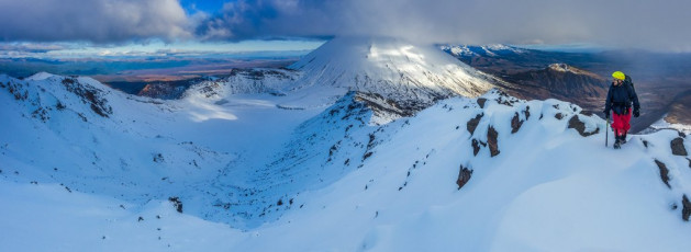
Our route left the main trail down at Mangatepopo Hut (1,190m) the afternoon before, crossing the stream and following the ridge all the way to Tongariro’s rime encrusted summit (1,967m). I’d been this way only a week before, but things had changed – for one the snowline had receded from about 1,250m to 1,650m. On my last visit we couldn’t see much, but now we were trudging in to a period of the most settled weather in weeks. With no snow I noted this time how, even here, a much more discernible path has been worn. We’d reached the summit a little before sunset, leaving enough time to find a suitably sheltered camp site, set up camp and heat water for dinner. This image - On our way up on the first afternoon, on Tongariro's summit (1,967m), with Ngauruhoe (2,287m) behind.

Camping up on top put us in position to enjoy what MetService had accurately predicted would be a primo, blue bird day in what really is a crater-pocked landscape. Our route skirted around North Crater, across a large flat plateau. From there we dropped 100 metres on what proved to be the steepest section of the day, requiring some front pointing, to the northern end of the main crossing trail above Ketetahi. This image - Making our way around North Crater, with Ngauruhoe's summit behind.
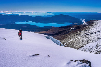
Then we climbed again, eastward to the top of Rotopaunga (1,856m) and gazed out over Lakes Rotoaira and Taupo to the north. In the foreground lay Te Mari (1,739m), the site of Tongariro’s most recent eruption on 6th August 2012, which sent an ash cloud five miles into the sky. For us, while some white geothermal steam lazily twisted its way skyward, there were virtually no clouds to be seen. This image - At the east side of the North Crater Plateau, looking towards Ketetahi and Lake Taupo.
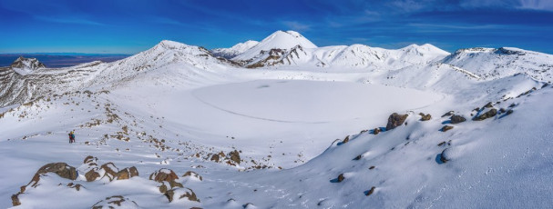
From Rotopaunga we dropped again, this time skirting the eastern edge of Blue Lake, which is another water-filled and, in winter, frozen crater. At its southern end is an un-named 1,850 metre highpoint. This image - Heading around the eastern side of Blue Lake with, from left, Ruapehu, Red Crater, Ngauruhoe and Tongariro ahead.
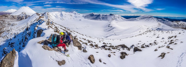
Perfectly located to enjoy lunch, we took in virtually our entire route, with spectacular close views of some intimidating vertical cliffs, Central Crater directly below and Red Crater just to the south. In warm sunshine and not a breath of wind, our enjoyment was further enhanced, as we watched a straggly line of guided ants plodding along the main route below. Both complete mountaineering novices, Juan and Raoul realised then just what a special kiwi outdoor experience they were enjoying, telling me it was the most impressive of their international backpacker travels so far. This image - On the 1,850m high point beyond the southern end of Blue Lake looking southwest to, from left, Ruapehu, Ngauruhoe, Red Crater, Tongariro, North Crater Plateau and Rotopaunga. Central Crater and Blue Lake are in the foreground.
Descent from our lunchtime high point saw us also back to the main route, which we would follow southward back to our cars. As we cramponed along, we met a couple of young guys in sandshoes, parkas and not much else. Granted, the conditions were perfect, but the irresponsible idiocy of their clothing had me shaking my head. Ignorance? Arrogance? Disrespect? Or a combination of all three!
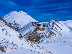
Even on a trail bereft of snow due to the heavy traffic it receives, it was still a 200 metre vertical slog up to the top of Red Crater’s rim from the southern edge of Central Crater. Unlike in summer, when the two little Emerald Lakes can’t be missed on this section of the trail, they were frozen and nowhere to be seen. Even so, each high point rewarded us with yet another magnificent panoramic perspective of the otherworldly volcanic landscape. After all, the Tongariro Crossing is famous for good reason. Our own tour of the Tongariro craters had certainly been memorable. This image - Red Crater and Ngauruhoe.
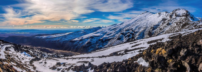
Tongariro and the ridge leading down to Mangatepopo Stream and Hut, viewed from the east on the southern section of the Tongariro Crossing.


