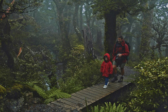
With Ed, then 6 years old, below Powell Hut
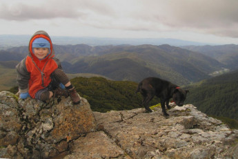
Will, then 4 years old, with Polly, beneath Powell Hut
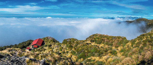
The trail up to Powell Hut and on to Mount Holdsworth is an ideal introduction to the Tararuas for youngsters – an easy way to get up on to the tops. There was a period, when my boys were younger, that I came this way fairly frequently. After a ten year hiatus though, I now saw how things had changed since this route has become part of the itinerary of international visitors. A graded footpath with civilised stair cases stretched right up to the junction where you can turn off in the direction of Totara Flats. The fun rocky section below Powell Hut has been overlaid with a significant section of stairs and, upon reaching the top of these, I was confronted with a ‘Powell Hut is closed for reconstruction. Do not enter’ sign. A flash new 32 bunker is coming soon. This image - A view south east from above the still in construction new Powell Hut
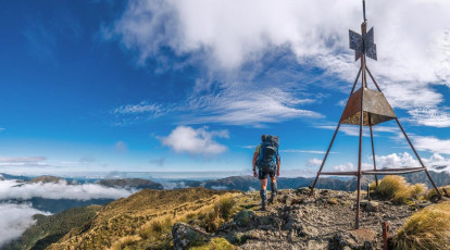
But no matter, my plan didn’t involve Powell Hut this time. I wanted to tread some new ground west of Holdsworth, plunging from Holdsworth’s trig at 1,470m, down a vertical kilometre to Mid Waiohine Hut at 380m. After a brew at the hut, cross Waiohine River and scramble all the way back up to 1,354m on the top Aokaparangi, on the main spine of the Tararuas. This image - Mt Holdsworth trig, looking west to Isabelle and the main range
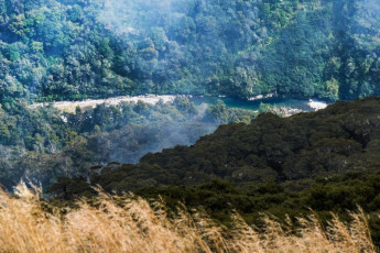
The weather forecast was optimistic, although by the time I reached the top of Holdsworth, there were big billowing clouds all around. My knees aren’t much of a fan of steep descents, so when the trail dropped 200 metres, only to then climb again to Isobell at 1,385m I was muttering things to myself like ‘here we go, typical Tararuas’. This became a regular thing over the next two days. This image - From Isabelle (1,385m), looking down 1,000m to the Waiohine River, near Mid Waiohine Hut
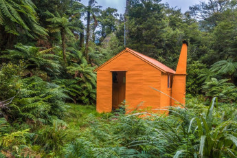
Mid Waiohine Hut (380m)
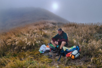
Since departing the Holdsworth carpark it took me ten hours to reach my bivvy spot just a tad east of Aokaparangi’s summit that evening. Most of the way had been in bush and it was humid. I had sweated profusely and constantly most of the time and some very unwanted chaffing, in various unpleasant spots, had become increasingly apparent. At least it was good to be free of the closeness of the bush for a while. On top though, I was engulfed in cloud and, with no tarns in sight, I had to use my water sparingly, knowing that Maungahuka Hut was still two or three hours walk away to the south. But with a good forecast, the main point of my trip was to be on the tops for dawn

Just as the light began to fade and I’d given up any hope of getting some sunset action, a clearing in the clag appeared. I grabbed my camera and quickly got onto the top of Aokaparangi. To the southwest a spectacular cloud formation had draped itself over the low point in the main range north of Maungahuka, hanging in space like a gigantic levitating waterfall
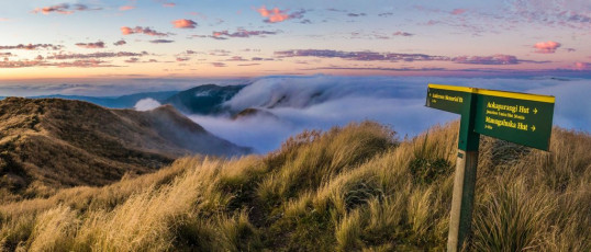
The view north was nearly as good, with huge suspended cloud-falls pouring over the top of Mount Crawford
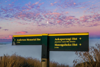
And above it all was a full moon, peaking from behind mottled mauve cloud. My day’s toils had been rewarded
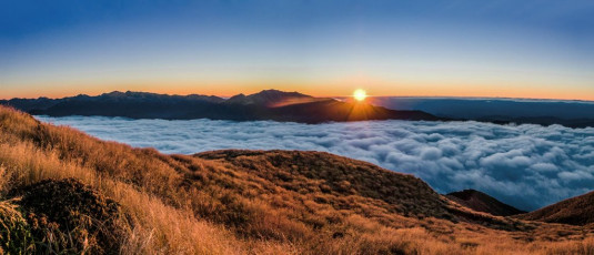
The night passed slowly as the clouds ebbed and flowed. Often a double halo surrounded the full moon, tempting me to climb out of my bivvy bag to take photos – well, almost. No trouble getting up for the dawn though. It was clear as a bell, with beautiful, delicately textured cloud driven down into the valleys by the cold of the night. The dawn unfolds slowly in autumn, so I enjoyed the ultimate landscape photographer’s scenario for a couple of hours. This image - At sunrise on Aokaparangi, looking east to Mt Holdsworth (centre)
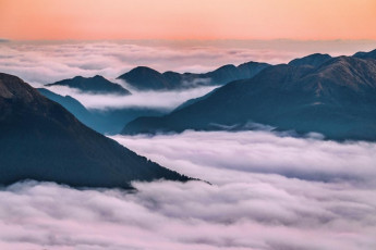
At sunrise on Aokaparangi, looking north to Carkeek Ridge (right)

At sunrise on Aokaparangi, looking south and west. At left is the main range leading to Mt Hector. In the distant right is the Kapiti Coast
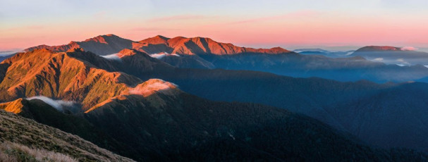
At sunrise on Aokaparangi, looking south along the main range to Maungahuka (left), then on along over the Tararua Peaks to Bridge Peak and Mt Hector, plus the Kapiti Coast to the right
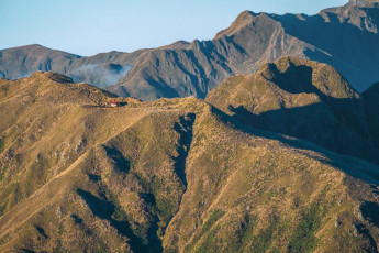
From the top of Aokaparangi it looked little more than an hour along the ridge to Maungahuka Hut, which gleamed at me in the early morning sunlight. The clear air was deceptive, as was my memory of this stretch of tops. It took about 500 metres of ups and downs, on sometimes quite exposed terrain, to reach the hut two and a half hours after setting off
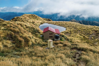
By the time I reached it the clouds had billowed back up out of the valleys. I took a breather at the hut, knowing that over 1,000 metres of descent to Neill Forks Hut awaited me, to be followed by 650 metres climbing back onto Cone Ridge, then another descent of 700 metres to Totara Flats Hut, virtually all in steep bush. This section was new ground for me so I was interested to see what unfolded
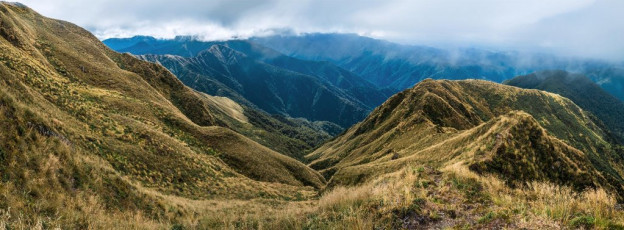
With tape applied optimistically to various chaffed areas I set off. On top of Maungahuka there was a clearing in the cloud cover and I got a glimpse of the ridge, dropping 300 metres before ascending again to Concertina Knob. Beyond the knob a plummet through goblin forest into beech awaited, ending at Neill Forks (350m). This image - The view down the ridge between Maungahuka and Concertina Knob (1,106m - far left). Maungahuka Stream cuts a path down the centre
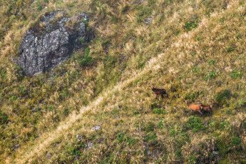
Looking intently back at me, about 200 metres below on the ridge side, were three deer. The cloud swirled and they were gone
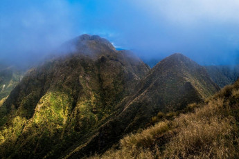
The same thing was happening to Tunui and Tuiti to my right. The swirling clouds made the Tararua Peaks look particularly ominous
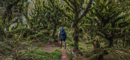
Entering goblin forest on the west side of Concertina Knob (1,106m)
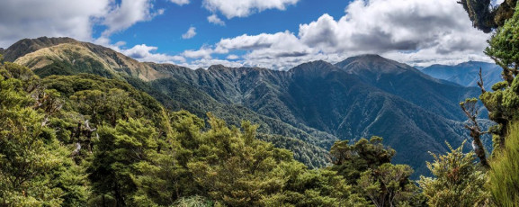
As I descended below 1,100 metres I came free of cloud and, through windows in the dense goblin forest, I enjoyed some nice vistas of the main range between Maungahuka and Aokaparangi to the north, then later of Cone Ridge, Neill and Winchcombe. Eventually the steep descent ended at a swing bridge crossing the Hector River. Immediately on the far side was Neill Forks Hut (350m). This image - A view from a peep hole in the goblin forest, west to Maungahuka (left) and north to Aokaparangi (right - in cloud)
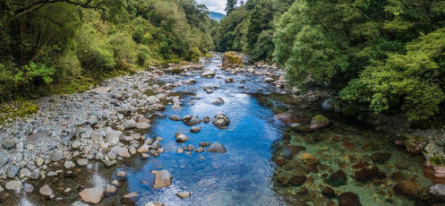
I would have liked to spend some time at Neill Forks Hut. Where Hector River is joined by Neill Creek is some lovely scenery. This image - Looking northeast from the swing bridge beside Neill Forks Hut, down Hector River

Neill Forks Hut (350m) and the swing bridge
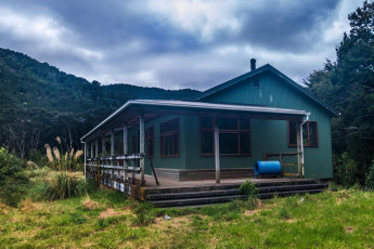
But it was already 4pm and I still had to get over Cone Ridge before dark. Another 650m climb and 700m descent later I trudged in to a deserted Totara Flats Hut, just on nightfall.
Next morning two previous ten hour days had me feeling old as I ambled, in light rain, along the Totara Creek Track in the direction of Gentle Annie. Making me feel even older was the thought that some Tararua hardmen have done what was taking me about 25 hours of walking in just 13 hours! Still, it was good to have added some new memories to my Tararua experiences. Note to self - get some merino undies …


