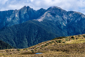
The day was a stunner. And it was hot. When I studied the topo map before setting out I couldn’t see any reliable water source anywhere between the Waiohine trail-head and Mount Hector. My route first went up 500m on the trail to Cone Hut, dropping a bit as it branched off north to Cone Saddle, then up another 500m to Cone at 1,080m. That had taken three hours and, when I arrived, a small tarn presented itself a little further along Cone Ridge. And it is actually featured as a tiny blue spot on the map – I’d just missed it.
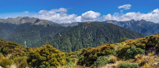
Ah well. Better safe than sorry on this hot day. The DOC sign indicated 4 to 5 hours down to the Waiohine trail-head, so I figured it shouldn’t take more than 6 hours more to Mount Hector if the sign indicated 6 to 9 hours. My bubble burst on the next section between Cone and Neill. On the map it didn’t look like much, but the reality was constant ups and downs, all through goblin forest. As I sweated buckets, I had to concentrate to stay on route. This image - The view from Cone, across Neill Saddle (900) to Neill (1,158m, right of centre), then left along the ridge to Winchcombe Peak (1,261m) and the ridge continuing on towards Mount Hector (1,529m - the broad mound far left)
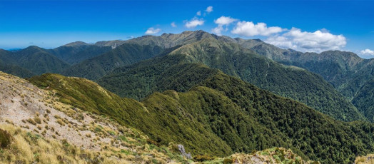
When I reached Neill two hours later I had a break and then had my water disaster. After releasing many expletives and sorting out my pack, which thankfully had everything in a dry bag, I shouldered my pack with grudging acceptance that it was going to be a very thirsty time until I reached Mount Hector. At least Kime Hut was a guaranteed water source from there. This image - The view from Neill (1,158) along the ridge angling right to the base of Winchcombe Peak where the treeline ends. This section involves a lot more up and down than it appears
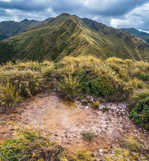
I took five eastward steps and a mud puddle emerged from behind tussock. ‘Yesss. Looks a bit manky, but a far better option than dehydration.’ I managed to get more than a litre of reasonably clear water before setting off once more. ‘Whew’.
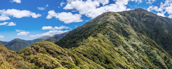
The next section between Neill (1,158m) and Winchcombe Peak (1,261m) was harder than the last. In a few spots two hands were required and the amount of up and down intensified. By the time I emerged from the goblin forest beneath Winchcombe Peak I was even happier than usual to finally reach the open tops. This image - At the western end of the ridge beneath Winchcombe Peak
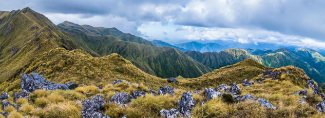
By now it was mid afternoon and a light breeze cooled things down – certainly better than the humid closeness of the goblin forest. But the going remained focussing, with several steep exposed sections to pass before I eventually reached a nice flat spot just ten minutes east of Mount Hector. It had taken me 7.5 hours to get from Cone to here so, once I’d boiled my puddle water, the tea tasted very good. This image - Looking west, up the final section of ridge, beneath Mount Hector
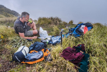
It had become cloudy on the tops, so I settled in for a long night in my bivy bag, perched on top of springy tussock. I hadn’t seen a soul all day, but when Hector’s summit cleared for moment in swirling cloud just on sunset, a tiny figure looked back at me from beside the memorial cross. During the night cloud continued to swirl. At times I got beautiful glimpses of the night sky, but I had no great expectations for the dawn.

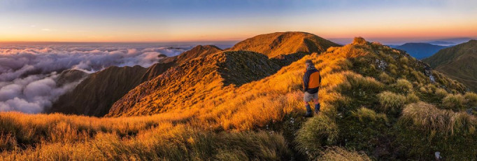
Splot! A drop of water from one of the blades of tussock that had been tickling me throughout the night hit me in the eye. I checked my watch – 5am, then looked around me to see a glorious scene. Sections of tops poked out of a sunken cloud blanket cloaking the lower slopes. The Horizon showed the first crimson signs of the new day approaching. ‘You little beauty!’ This image - Dawn view east, along Neill Ridge, towards Winchcombe Peak
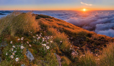
For the next two and a half hours I captured the unfolding sunrise in pixels, while also getting ready to move on. The landscape was spectacular, the light luxuriant and the immediate foreground coated in white alpine flowers. I felt rewarded many times over for the hard slog of the day before.
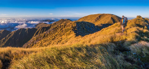
When I’m in the hills my appetite isn’t that strong and often I’d rather drink than eat, especially during summer months. I had to ration my puddle water too, in order to avoid a two-hour-return side trip to Kime Hut for more water, or at best, an hour-return to reach a small tarn beneath the south side of Field Peak. I’ve found that iced coffee Up and Gos really are the business – a morning coffee, a drink and a breakfast all in one, requiring no preparation or utensils. This image - Dawn view along the final section of ridge to Mount Hector (centre), the Beehives (left) and Kapakapanui and Kapiti Island (distant right)
On my way to the summit I was surprised to pass another tarn I’d not been aware of. This one doesn’t show on the map either. With two spare Up and Gos still in my pack, I decided to plough on, knowing that Alpha Hut was not too far away and the morning air was still fresh.
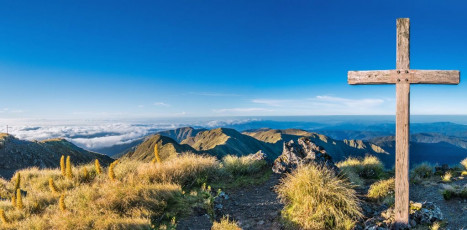
At 7.45am I was taking more pictures beside the memorial cross, erected by the Wellington Tramping Club in memory of trampers and climbers killed in the second world war. This image - The memorial cross on Mount Hector, looking south
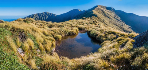
Then, for the next three hours I trod familiar ground around to Alpha Hut. That clear morning I’ve never been on this section in better conditions – perfect for photography and no-one else to be seen. This image - A small tarn to the south of Atkinson, looking back towards Atkinson. Mount Hector is centre and Field Peak left
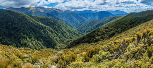
After a rest and major rehydration stop at Alpha Hut (1,100m) I was ready to push on for home. After a drop down to Hell’s Gate at 1,000m, I took the left branch, back on to new ground on the trail to Bull Mound. Unlike yesterday, this proved to be easier than expected – a nice, gradually climbing, open trail, offering wide vistas of Neill Ridge and the main range. This image - A view north from about 1,100m, on the trail between Hells Gate and Bull Mound

From Bull Mound (1,080m) the trail dropped directly down to Tauherenikau River (300m). I was expecting a wade across, but a large tree had fallen right across the flow, providing a dry crossing option. Once on the east bank, I drank my fill from the river, before preparing for a final 350m climb beyond Cone Hut, which I was glad to have behind me. At 5pm back at my car, it felt good to get the boots off. Seven toe nails were blackening in true Tararua fashion. This image - A view from near Bull Mound of Neill Ridge, with the main Tararua range behind. Winchcombe Peak (1,261m) is left and Neill (1,158m) right


