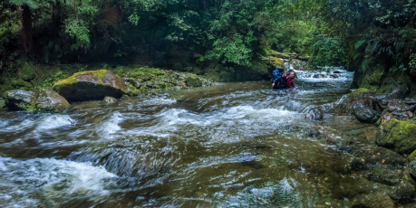
There isn’t that much of New Zealand’s back country Shaun’s boots haven’t trodden, but his planned eight day route in the Kahurangi National Park would take him to some new territory. The entire route was new for me. Our entry point would be Baton Valley Road, heading over Baton Saddle to Karamea River, then up again over Sandy Peak and the Herbert Range, down and around the base of Mount Kendall to Trevor Carter Hut, up again to Biggs Tops, down to Stone Hut, up and over to Kiwi Saddle, up Mount Patriarch and then along the Arthur Range as far as John Reid Hut, finally exiting via the Wangapeka River Road. Quite a hike. Joining us were two of Shaun’s long time hill buddies Darryn Pegram and Steve Baker. Three of us are very keen photographers. Darryn used to be too but these days he’s happy to leave his camera gear behind. He became our super model, stalked by the paparazzi at every photogenic spot. This image - Shaun and Darryn making one of many crossings on our way out.

An initially favourable but deteriorating weather forecast prompted our first evolution to the plan. Shaun figured that, by reversing our route, we could get up onto the tops rapidly to enjoy the first four days of mild weather. By the afternoon of day four rain was expected and, beyond that, well who knows in this climate changing world. With packs over 20kgs, the initial climb up to John Reid Hut and then on to the southern end of the Arthur Range seemed pretty brutal. No pain no gain though and we certainly made a gain. For photographers, our bivvy spot at 1,463m that night, then the one two nights later on Biggs Tops, were visits to heaven. This image - A dusk view from our 1,463m campsite on the Arthur Range, spanning the Luna Ridge and Mt Baldy (far right).
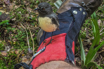
In sodden boots from crossing the Wangapeka River at our midday taxi van drop off point, it took about four hours to reach John Reid Hut at 1,240m. As soon as we entered the forest inquisitive little Robins flitted here and there, coming very close to check us out. During the next week I saw a greater variety and proliferation of native birdlife in one place than ever before. Robins and Weka everywhere. Blue ducks, Fantail, Tui, Bellbird, Kereru, Tomtit, Kea, Kakariki. Normally you need to pause and tune in to hear birdsong in our forests, but not this time – it was constantly all around us. I’m told that Kahurangi National Park is one of the areas longest receiving 1080 drops. Our experience seemed anecdotal proof that it’s working. This image - An extra close encounter on the trail between Stone Hut and Wangapeka Saddle.
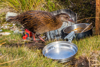
Up at John Reid Hut a friendly party of local tramping club members were busy refurbishing both inside and out. With them and the weka it was busy, but we only lingered there to have dinner and replenish our water supplies before heading up onto the ridge, part of the Arthur Range, above the Hut.

As darkness fell we settled into our tents and bivvy bags to enjoy a moody sunset. Dawn was even better. Parts of our intended route to the west emerged in mauve and pink hues, as the sun approached the horizon on our eastern side. This image - A dawn view from our 1,463m campsite on the Arthur Range, looking west and north to the Luna Ridge.
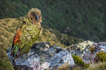
Darryn was first to set off about 8am, me being last to leave as gravity pestered my bowl. Another mandatory bivvy and hut weka emerged to see me off as I set off along an undulating ridge in the direction of Mount Patriarch. I caught the others up where they’d paused to watch a Kea and soak up a superb view of Patriarch. Our route down a spur to Kiwi Saddle Hut was also apparent.
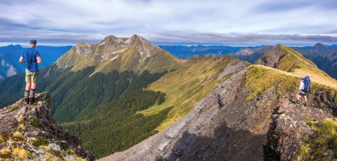
At the saddle beneath Patriarch Darryn and Steve decided to go directly on to Kiwi Saddle while Shaun and I scampered pack less, up the 340 metres between us and Patriarch’s summit at 1,701m. On top we enjoyed superb 360 degree views and an opportunity to eyeball much of our intended route. We joined the others down at Kiwi Saddle Hut (1,000m) for lunch. The weight of our packs now played on our minds as we prepared to head on up again to a 1,400m saddle beneath Mount Luna. This image - On the Arthur Range, looking to Mt Patriarch (1,701m right and 1,692m left). The third lower peak is the site of a trig at 1,600m.
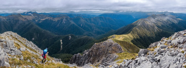
A summit view from Mt Patriarch. The ridge stretching right is the Arthur Range. The ridge leading left gives access to Kiwi Saddle and Luna Ridge.
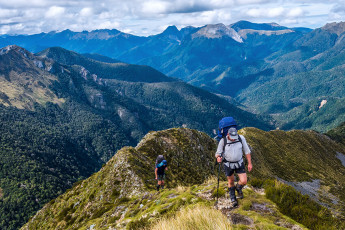
As we made our way up towards the treeline, competing with the birdsong, a more sinister low hum became apparent - wasps. Sadly they were ever present in the Park and we would get to know them more personally in due course. Above the treeline we joined a narrow rocky ridge leading steeply up to a 1,400m point overlooking picturesque Luna Lake, some 200 metres lower down. From there we sidled around the east side of a 1,578m peak to reach the saddle beneath Mount Luna, also at 1,400m. This image - Ascending the steep section to 1,500m. The Arthur Range spans the skyline, with Mt Baldy centre.
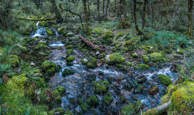
The saddle gave access to the head of Stone Creek, which we followed back down through exceptionally beautiful emerald moss-clad, water fall festooned forest to Stone Hut, back down at 700 metres. It had been a long 10.5 hour day. Shaun, wearing one of those fancy new step meter watch smart devices, reported “We’ve done 33,900 steps today, more than four times the World Health Organisations recommended daily amount.” Be that as it may, according to our schedule, by the end of day two we should have reached Trevor Carter Hut down at 500 metres, requiring another climb over 1,300 metre Biggs Tops to reach. This image - A section of Stone Creek at about 1,000m.
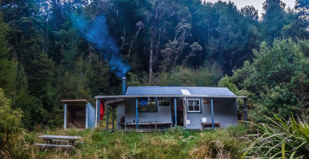
Our schedule was proving to be more ambitious than we’d thought. With deteriorating weather on its way, too ambitious. Time for another evolution! Instead of carrying on beyond Trevor Carter Hut to the Herbert Range, we reluctantly agreed to head east down the Karamea River and, weather permitting, enjoy some more tops travel above Baton Saddle. This also gave us good escape options if the weather really packed up. Decision made, we enjoyed a cosy evening in the hut. This image - Stone Hut (640m).
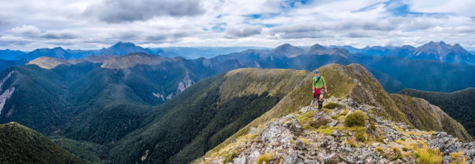
Next morning dawned calm with high cloud, perfect hiking conditions as we pushed on to Wangapeka Saddle at 1,010m. From there we all dropped our packs and clambered up a steep slope onto the tops beneath Nugget Knob, a 1,505m high point. The summit proved to be further than expected, but well worth the effort for the views and the enjoyable, rocky, knife edged ridge beneath the summit. After lunch back down at the saddle, we shouldered our packs and headed on upwards again to Biggs Tops at 1,300m. This image - Looking north from Nugget Knob, back along the approach ridge. Wangapeka saddle is in the dip left of centre, with the Biggs Tops and Mt Kendall beyond. Mt Patriarch is far right.
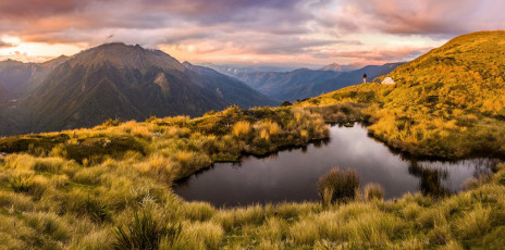
To secure a water supply for our bivvy site up on Biggs Tops, we had to abandon the poled route leading on to Trevor Carter Hut, branching right/east to a lovely tarn nestled in a small basin, arriving about 5pm after about seven hours of hiking. If anything, this spot was even more impressive than our first bivvy back on the Arthur Range. This image - A dusk view across the tarn to our campsite and Mt Kendall.

And the light show unfolding for us that evening definitely was. Godly shafts of light poured over the Scarlet Range, spotlighting areas otherwise in shadow beneath us.

Dawn next morning was just as impressive and it was fun to share such photographically dreamlike conditions with the others. Normally I’m the only keen photographer on my trips, with my companions sometimes looking sideways at me as I rave on about the light and so on. Not this trip – we were like a litter of piglets in warm mud as we captured the moment.
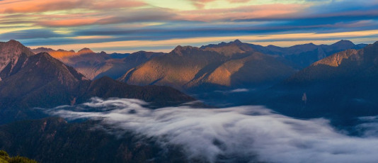
Looking northwest in the direction of Kakapo Saddle.

If we’d followed the original plan we’d have missed all this tops action because, as day four wore on, the weather slowly began to deteriorate. As it was this wasn’t a problem because, once we dropped steeply off Biggs Tops to Trevor Carter Hut (500m), the next two days were all in the forest, tracing the Karamea River.
This image - Looking across the tarn to the Scarlett Range (left), Mt Herbert and Mt Kendall (right).
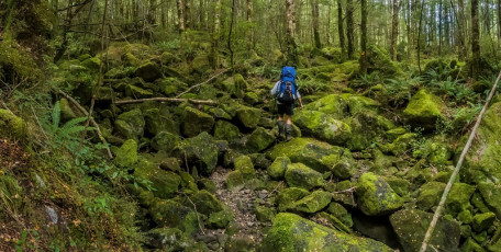
From Trevor Carter we meandered on to Thor Hut (450m), then further on to Venus Hut (390m). This was an easy six hour day and, below Venus Hut, is a lovely swimming hole where we washed away several days of grime and cooled off in the warmer river valley climate. This image - A moss-covered boulder field south of Thor Hut.
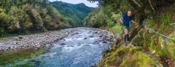
The following day was similar as we carried on down river, past Crow Hut (330m) to Karamea Bend Hut (280m).
On our sixth day the rain began to set it. It was time to climb again, up to Baton Saddle over a 1,000 metres above. The previous two days had allowed us to rejuvenate, but we still weren’t quite prepared for what confronted us on the lower section of the climb to the Saddle. This image - The Karamea River, not far from Venus Hut.
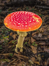
Fungi near the trail, north of Crow Hut.
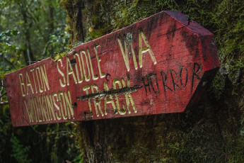
At the trail junction with the Leslie Karamea Track, carved into the old sign stating “Baton Saddle via Wilkinson Track” was “Horror”. Some other knowing soul had also penned “Total”. At the time we chuckled but it wasn’t long before, pouring with sweat, we were struggling up steep, slippery mud and boulders. To up the ante stinging nettles made an appearance and steadily proliferated. But wait, there’s more … wasps, nests of angry wasps.
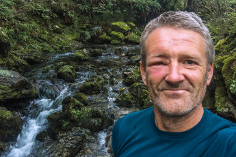
At one point the combination of slippery exposed rock and stinging nettles became impassable. We were forced to abandon the semblance of a trail in favour of a semi-vertical, moss covered boulder field. I took a tumble into a cluster of nettles and, just as I thought we’d dealt with the worst of it, I looked up directly into a small round hole with wasps coming in and out of it. Oh shit – things went a bit silly as I tried to get as far past the hole, as quickly as I could. Sting to the leg, sting to the head, many expletives and flapping of hands. Then, no more stings – thank goodness for that. Shaun and Darryn were also stung. At least the gradient soon eased off and we left the nettles behind. This image - a selfie taken that evening beside the upper section of Baton River, beside Flanagan's Hut - wasp impact evident.
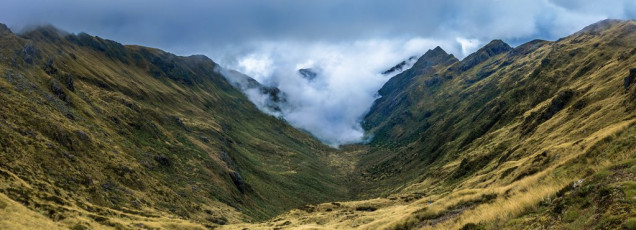
Up at about 1,000 metres we paused for lunch and antihistamines, before tackling a final steep 350 metre section leading to Baton Saddle at 1,340m. Up there clouds obscured much of the view – enough to shut down any thoughts of proceeding along the tops. Looking down the south side of the Saddle didn’t fill us with joy though either – steep slippery tussock clods and a legion of spikey Spaniards. Slowly we picked our way down to a sodden wetland basin that eventually gave way again to forest. Soon we reached Flanagan’s Hut (940m) – a little under eight hours after leaving Karamea Bend Hut, but a fairly intense eight hours nevertheless. This image - The view south from Baton Saddle (1,370m), a sea of Spaniards and deep tussock.
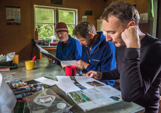
Eight bunk Flanagan’s Hut is situated in a small clearing just 20 metres from Baton River, which is really just a stream at that altitude. The Hut exudes a certain charm lacking in some of the more modern huts in the Park and was a cosy place to stay that night, as the intensifying rain rattled on the roof.
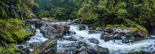
On the morning of day seven a pair of rowdy weka woke us unceremoniously. Just as well though, because the extent to which Baton River had swollen, even beside the hut, left us in no doubt that time was of the essence. With all thoughts of a final stint on the tops a distant memory, we started our wet and slippery descent, which required half a dozen crossings of Baton River. It was fortunate we had four in our party, because our last couple of crossings required all four to bind together to safely ford the waist deep torrent. It was the most extensive swollen river experience I’ve had and I was mightily impressed at how stable a four, or even two man fording team actually is. This image - Approaching another river crossing on the lower section of Baton River.

Wet and weary, we found ourselves on the true left bank of Ellis River about mid-afternoon. Shaun had our taxi van pickup all set, except that we were now a day early and hadn’t been able to get a cell phone signal anywhere to bring our pickup forward. Nothing for it but to start walking the gravel of Baton Valley Road until we got a signal. Ah well, at least the drizzle had stopped. As it was, after a few kms of trudging a Ute appeared from the opposite direction. We flagged over the driver, a local farmer, to ask if he knew how far it was to a signal. “Not till the far end of the valley, fifteen or so kms away. But how about I drop this ram off (sitting in a cage on his Ute deck) and come back and drop you down there?” he explained “Hell yes!” was our reply. Definition of good sort!
Less than three hours later we were showered, changed into clean dry clothes and supping our first beers at a Nelson pub as the rain continued outside. With the benefit of hindsight we agreed that our trip evolutions had all been good calls. Whilst Shaun’s step meter confirmed we’d taken about 180,000 steps and my altimeter indicated a cumulative height gain of 4,600 metres and descent of 4,200 metres, we still hadn’t met all our objectives. But so what - the journey had been fantastic.


