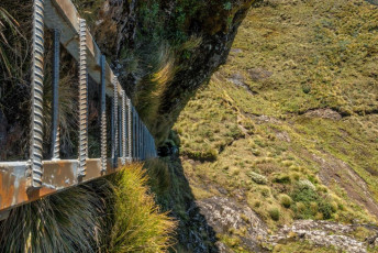
From the top of the ladder, between Tuiti and Tuni - the 1,325m Tararua Peaks
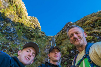
By the time I and my arthritic knees reached the top of the ladder in the exposed and craggy little notch between Tuiti and Tunui, the 1,325m twins known as the Tararua Peaks, Ed and Will were already lounging nonchalantly at the bottom. Damn it, I wanted to get some shots with someone on the solidly constructed aluminium structure. “Ed, climb up a bit so I can shoot you.” To do that I had to gingerly dismount the ladder onto steep tussock on the side of the ladder, then hook an arm around the top rung before going to that somewhat more precarious through-the-lens space. This image - at the bottom of the ladder
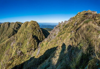
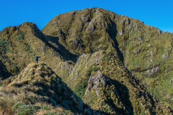
There are plenty of striking places in the Tararuas, but the ladder at the steepest section of the Tararua Peaks, just west of Maungahuka Hut, stands out to me. I’d seen photos of it – even a guy lugging his dog up it in his backpack. On my first visit I had a two-day space over Easter, so thought it was time I went and had a look myself. At the time, the photographer in me knew I’d have to come back in better weather. And with a bit more time. The circuit from Otaki Folks, up past Field Hut to Bridge Peak, then along the main range past Maungahuka Hut, Anderson Memorial Hut and over Junction Knob, then plunging down to Otaki River and Waitewaewae Hut, before returning to Otaki Folks is physical – even for testosterone-pumped, energetic teenagers. This image - on Tuiti, with the notch giving access to the top of the ladder

According to my flash new Garmin watch, this circuit is 54.73 horizontal kms and, more tellingly, 4,013 vertical metres of ascent and descent. Having now done it in two very long days and then, five years later, in two and half slightly more leisurely days, the latter is definitely recommended. Aside from avoiding exhaustion, more time permits space to soak up and photograph the fabulous scenery. This image - Climbing above Table Top towards Bridge Peak (1,421m), with the main Tararua Range stretching left
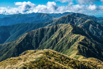
It was nearing the end of the first week of the April school holidays and not much was happening. “Okay guys, it‘s looking good for a two-day weather window this coming Sunday/Monday. Time to put your screens down and gather some gear together.” A few grunts confirmed that they understood. To be fair, as far as teenagers go, Ed and Will have probably seen more of their own country than most. And at 17 and 15, they’re starting to build some real hill condition. As we completed packing I enjoyed the realisation that I no longer had to carry any of their gear – 14kgs or so a piece – civilised! This image - On the descent from Bridge Peak on to the main Tararua Range, looking north east
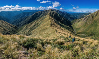
With such changeable weather, I wanted to be on the trail first thing on the Sunday so we could hopefully enjoy clear weather between Bridge Peak and Maungahuka Hut. In the car park, just before 8am, I chatted briefly to a guy who was looking after a group of kids on a geological trip. He mentioned that a party of trampers had taken over ten hours to get out from Waitewaewae Hut the day before, due to a slip somewhere along the route. Hmm, last time I came that way it had taken four hours. I hoped we weren’t going to endure a sting in the tail this time. “But it’ll be what it’ll be. Right now it’s time to climb.” This image - On the descent from Bridge Peak on to the main Tararua Range, looking north east, with Hector River right and Penn Creek left
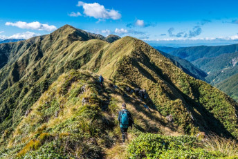
The trail from Otaki Folks (80m) all the way up, pretty much, to Bridge Peak (1,421m) is in very good condition these days and is almost all up, allowing quick progress. As we climbed out of the bush on to Table Top, I was heartened to see that the heavy cloud draped over the main range to our left had started to break up. By 12.30 p.m. we’d finished lunch at Bridge Peak and set off eastwards down towards Boyd Wilson Knob, at 1,138m, the first of four named high points that steadily climb again to the Tararua Peaks at 1,325m. I didn’t count how many un-named points there are, but certainly several more. This image - On Vosseler (1,198m), with Yeates (1,205m) right
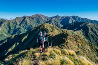
On cue, the cloud had cleared and I revelled in the lovely photographic conditions – polar opposite to what I’d encountered five years earlier. By this stage Ed and Will were effectively demonstrating to me how much I seem to have aged in the past few years, leaving me to spit out dirt and tussock as they loped their way up and down the craggy ridge.
Boyd-Wilson, Vosseler (1,198m), Yeates (1,205m) and McIntosh (1,286m) were all quickly negotiated. The engaging terrain often required hands as well as feet. In the bright conditions it was really enjoyable. The next steep section was constantly unveiled as we drew nearer to the Tararua Peaks. To the west Kapiti Island came into clear view, as did the Wairarapa to the east.
This image - A view From McIntosh, south west, back along the main range
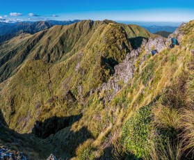
“So just how big is this ladder Dad?” Yes, its reputation was having its usual effect on the boys. ‘Keen with a touch of apprehension’ summed up their demeanour as we reached the top of the trail, just beneath Tuiti’s summit. While we tended to an emerging blister on Will’s foot we also soaked up the heady ambience. Ahead was a very steep, two hands required, partially cable protected drop to a small notch. Beyond that was ‘the void’. This image - descending to the notch
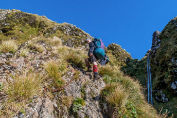
It was in the 1930s that intrepid trampers first pushed a route through the Tararua Peaks. Using climbing ropes for protection, they took several attempts to crack it. Later, the Tararua Tramping Club installed a wire cable, which I imagine would have been a fairly focusing ascent or descent tool, especially in wet conditions. The cable was later upgraded by the Forest Service to a chain ladder. Pictures reveal a wobbly affair that, at least, would be preferable to a single cable. DOC fixed the current aluminium ladder in the early 2000s. About 25m high, with over 70 rungs, it’s an impressive and very effective way to get up or down the crux section. This image - Climbing Tuiti (1,325m)
After a flurry of photos, I joined Ed and Will beneath the ladder. “So the hut’s not far now eh?” asked Ed. “Must be close” was my reply. I went on ahead so I could photograph them coming towards me around the dramatic, chain-protected section skirting underneath the summit of Tunui, before rejoining the main ridge. Back on the ridge, I copped some flak from the teenagers when they discovered how far away Maungahuka still was. My clouded memory of my first visit clearly needed some updating. This image - On the chain protected route beneath the ladder, which goes beneath Tunui before rejoining the ridge west of Maungahuka Peak (1,330m)
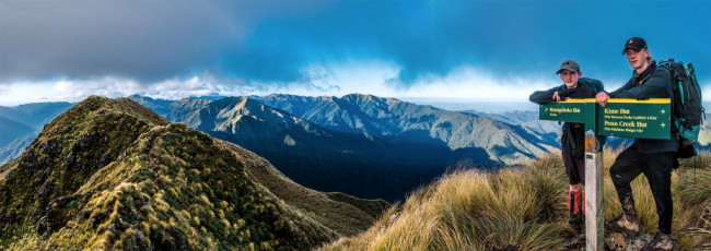
As it was, we were soon getting a selfie at the DOC sign on top of Maungahuka (1,330m). The clear weather slowly gave way to swirling cloud as we dropped down to Maungahuka Hut at dusk. I lingered for more photos, enjoying some beautiful cloud-at-sunset light. And life got even better after entering the hut. Four room temperature, i.e. chilled, bottles of Kiwi Larger sat gleaming appetizingly at me from the bench. Nec minute there were only three left and I felt considerably refreshed. The hut book revealed that two hunters had left them behind for all comers – legendary behaviour.
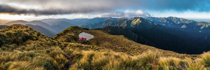
Twelve-bunk Maungahuka Hut, nestled into the tussock hillside beside a pretty tarn at 1,280m, deserves its reputation for being situated in one of the Tararua’s most spectacular spots. This became even more apparent, when I looked back from the ridge north of Anderson Memorial Hut the next afternoon, to see the main range unfold in clearing cloud. Right in the middle, at what appeared to be near the highest point, sat a tiny red dot commanding unimpeded views.
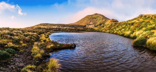
Maungahuka Hut and it's tarn, with Maungahuka (1,330m) behind
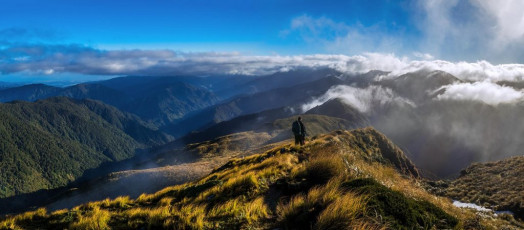
After enjoying a comfortable night, we set off along the main ridge in the direction of four more named high points, the first being Simpson down at 1,138m. Our weather window began to close, but we still enjoyed dramatic clearings, interspersed with swirling moody cloud throughout the day. I was surprised to encounter some more quite exposed, steep terrain between Simpson and Aokaparangi (1,354m). Again my clouded memory got a refresh. This image - The view north just beyond Maungahuka Hut to Simpson (1,138m), Wright (1,196m) and Aokaparangi (1,354m), in cloud at right
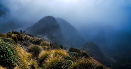
Beyond Aokaparangi was Kahiwiroa (1,320m) and, a little further north again, we encountered my bivy spot of five years before. Today, easily-seen poles mark the trail off a broad, multi-spurred section back into the bush. On my first visit, in dense cloud, no poles existed. The many spurs all seemed viable descent options so, rather than risk taking the wrong one, this is where I bivvied for the night. I should have got my compass out, which is what I did next morning in the persisting cloud, soon locating the first reassuring cairn leading down to the bush. This image - Descending the northern side of Wright
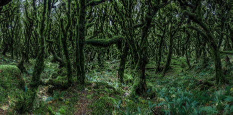
This time we had no need for a compass and, immediately after breaching the bush line, were confronted with an unexpected and dramatic contrast – some of the finest Goblin forest I’ve ever seen. The boys went ahead while I tried to do photographic justice to it.
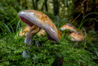
As I neared Anderson Memorial Hut, I came across a variety of other forest treats – all manner of fungi, which provided me an opportunity to try out the macro mode on a new hill-friendly compact camera I was taking on its maiden voyage.
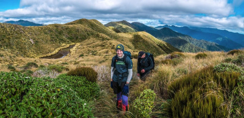
“Ahhhh jeeez Dad!” At Anderson Memorial I copped further flak. My estimate of about seven hours to reach Waitewaewae Hut was proving to be optimistic. At one point I’d even floated the idea of dropping packs at Junction Knob for a quick scoot up Mount Crawford. (“Jeeez Dad!”) So lunch at Anderson Memorial had to be a 15-minute affair to increase our chances of reaching Waitewaewae before nightfall. This image - A view south, at about 1,200m, beyond Anderson Memorial Hut
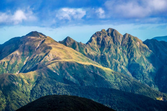
The terrain beyond Anderson Memorial, up over Junction Knob (1,375m) and down off the main ridge via Shoulder Knob (1,320m), is considerably easier terrain than what we’d travelled to the south. But the relentless 1,000 metre drop through forest, over slippery roots and mud, to the Otaki River had my knees administering me some flak too. This image - The Tararua Peaks (right) and Maungahuka Peak and Hut (left), viewed from the north of Anderson Memorial Hut
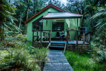
We trudged into the Hut just as it was getting dark and drizzle was setting in. No cold Kiwi Larger this time. I’d considered bringing one with me from Maungahuka but knee concerns deterred me. Voltaren would have to do. This image - Waitewaewae Hut (290m)
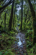
We awoke to the pattering of rain on the roof as I pondered what lay ahead – that slip I’d been told about. A small notice on the wall of the hut indicated that a new, higher route had been cut. At some point. Nothing else. Off we trudged into the rain. It was wet but not cold. Up on Plateau (530m) I knew to expect a junction point soon. Sure enough, a sign clearly recommended the left option. The sign for the right (old) route simply said “Good luck!” This image - An uncharacteristically straight and flat section of Tararua bush trail near Plateau (530m), on the trail out from Waitewaewae Hut
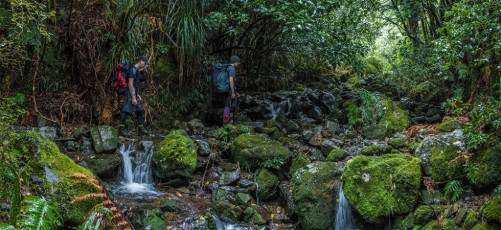
The left option proved to be absolutely fine. I had expected something pretty rough and ready, but it was clearly marked and traversed around a contour line much of the time. We reached Otaki Folks after five hours, puzzled about how that other party had taken twice as long. I guess their luck had run out. Ours certainly hadn’t. We’d enjoyed two and half superb days in some of the best the Tararuas has to offer.
“So how was it Will?”
“Yeah, alright …”


