By Andy Carruthers (February 26, 2018)
When you look at the map of the North Island there is a huge wilderness area east of the desert road all the way out to Hawke’s Bay.
A few years ago I tramped a magic loop on the edge of this area up the Waipakihi river and back over Umukarikari.
The Big Sunday Run crew had done a few missions in the area and there was chatter about a trip in February. We circled a weekend in the calendar and started to plan.
I found a route in my Classic Tramping book, a gift from my father in law that inspired our Tararua SMR trip two years ago.
The classic Kaimanawa Kaweka traverse has a big block of private land in the middle of it. Thanks to the generosity of the land owners there are permits available when the hunting blocks are not being used (https://wilderlife.nz/2017/04/kaimanawa-ranges-access/).
We found an account of a tramping group that had done the trip and started to map out our plan.
My father in-law connected me with one of his tramping friends in Turangi to find out about possible transport options. Kevin was incredibly helpful, not only did he offer to provide transport, his son Robert had done the trip a few months earlier and was able to help with the trip planning.
After getting all the info we could, we made a plan.
We would set off from Kaimanawa Rd on Friday afternoon and if the weather was good, we would bivi next to the Rangitikei River (estimated time of seven hours). Saturday we would cover the rest of the Kaimanawas including the the island range, the high point Makorako, the river valleys of the Mangamingi and Ngaruroro and spend the night at one of the huts in the Kawekas — hopefully Te Puke to keep Sunday as manageable as possible (estimated time of 15 hours). Sunday we would head out to the road end at Makahu Saddle (estimated time of nine hours).
We had a group of four adventurers who were keen and available that weekend. Marta was keen for some more GODZone training, Al is a true explorer and loves new country, and Anthony was very excited about the route — one of his relatives had trekked it when they moved to a Hawke’s Bay School back in the olden days. I was stoked to be doing a big adventure in new country.
The weather thumbnails were looking promising as we did our final packing. Cyclone Gita was going to hold off until we finished. This was my first two-night fastpack trip and getting our gear and food right was going to be helpful for a successful trip.

I found a freeze dried back country adventure food pack and added my normal muesli bars, chocolate bars, ten Kransky sausages and lots of tailwind for my drink bottles.
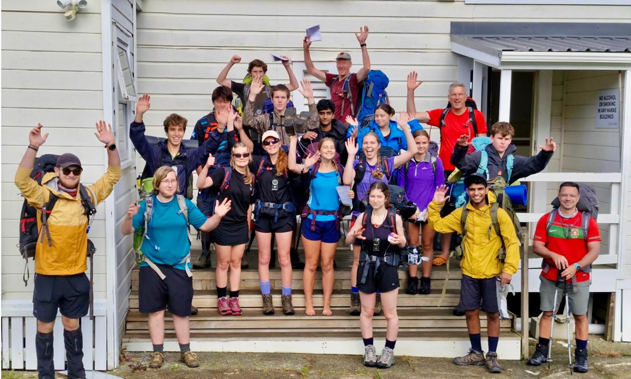
We met Kevin at the Kaimanawa Rd turn off and set off up the Umukarikari Range. There were two school vans at the car park.
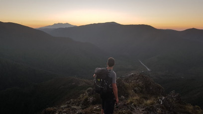
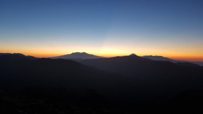
It was a beautiful afternoon to be on the volcanic alpine tops of the Umukarikari Range. We had views for miles. I caught my first view of the steep rocky cone shaped Makorako, the high point in the Kaimanawa Range that would dominate the horizon for the whole trip. The school group were at Waipakihi Hut — they had traveled from the far north that morning and were enjoying the last of the sun from the deck.
The climb to junction top (1600m) was one of the most awe-inspiring outdoor experiences I have ever had. The sun was setting behind Ruapehu as we climbed the lovely alpine ridge and the vastness of the area was starting to make its presence felt. Standing on the top, we looked down into the steep Rangitikei Valley. It was dark and ominous and the lights of Taupo were our last glimpse of civilisation for two days.
This was the start of the private land for which we had a permit, as well as the end of the marked track. We had a GPX provided by Robert, but he hadn’t followed this route due to hunting activities that meant his permit required he cross the Rangitikei further south. We dropped down into the valley under headlamps trying to follow the GPX path. It was rough and lots of scrub meant we were bush-bashing quickly. Soon we were stuck in a creek and bluffed out by a 10m waterfall. We got on our hands and knees and crawled through the scrub until we finally got back onto the spur, which meant we could stand up. Marta announced rule number one for the trip: if we have to crawl, we would turn back and find a better path.
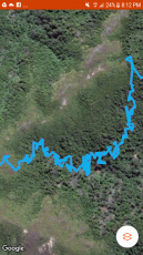
We continued to bush-bash down to the Rangitikei, which was hard and slow progress but we finally we got to the river. We could see a little island up the river that looked promising for bivi spots. We found a nice spot to sleep and boiled some water for a late dinner. Sitting there in the middle of nowhere after a tough few hours brought on the magnitude of the adventure we were on. Halfway into tomorrow (Saturday), we would be about as far away from civilisation as you can get in the North Island.
We didn’t get much sleep, as it was cold and we were travelling light. My experiment of not bringing a sleeping bag was a failure. My bivi bag was fine for a hut but not for being outside at 1,000m. I set up my camera in the night to capture the stars and when I got the camera from the river bank, it had been moved by some animal and was sitting upright no longer facing the stars. I hope I got the shot!
We set off with the fear of more bush-bashing. The river was beautiful, so clear with blue ducks playing in a magic looking swimming hole. No time for swimming yet. We wandered down the river hoping to pick up the sign of a route where the GPX left the river. All of a sudden Al appeared at the creek we had come down last night. He had been delayed leaving town and was planning to sleep on the tops and catch us at some point this morning. It was great to see him arrive safe.
We found a cairn and to our surprise a good route out of the valley on to the island range. Today we would cover the moist alpine island range, the range with Makorako as the high point in the Kaimanawas that dominates the horizon, and the subalpine scrub areas of Mangamaire. In the heart of the area were the river valleys of the Mangamingi and Ngaruroro. We would finish the day entering the Kawekas in the beautiful beech forest with moss-edged trails and tussock-covered valleys.
Anthony spotted a red deer looking at us from the next ridge. The top section was spectacular — easier climbing than our Tararuas with nice, wide runnable ridges. We got caught in a rough patch of scrub heading down to the Mangamaire and I had to put my over trousers on to stop the leg pain from the sharp scrub. I had a nice dip in the river before we headed up the next hill. Anthony stepped on a wasp’s nest that led to a furry of Italian swear words and some sprinting to get away. A few stings later, we settled into our afternoon rhythm of crossing rivers. It was about this time I realised I had been wearing my tee shirt back to front and inside out. The brain was clearly working slowly this morning! I got to try one of my new smoothie packets, which was a real winner. (Note to self to always pack those).
We reached the lovely Tussock Hut at 6pm and pushed onto Harkness Hut. Robert had warned me about how slow this section was with river crossing after river crossing in thigh to waist deep water on slippery rocks, which was tough work. It was great to find Harkness Hut was nearly as nice as Tussock Hut. We ate and crashed. It had been a big day.
It looked like we had 24kms to cover on the last day and were getting picked up at 3pm. It ended up being 31km. Lucky we left at 7am (thanks Al). My timing estimates are often optimistic, which can be problematic.
The top sections in the western Kaweka Range are a nice mix of greywacke and alpine scrub, while the barren loose rock looks like its from another planet. In between these are the beautiful beech forest trails lined with pretty moss verges.
The only people we saw from Waipakihi Hut to the end were a dad and his sons who had helicoptered in to do some hunting. We ran lots of the ridges and had our breath taken away by the views.
There is a special feeling that comes from an adventure like this — a mountain adrenaline that makes you feel fantastic.
Huge thanks to Kevin and Robert for their help and to my fellow adventurers.
The trip took us 28 hours hiking time, including the odd quick water stop. We started Friday afternoon and finished by Sunday afternoon.
FMC thanks Andy Carruthers for his permission to reproduce this article, first published on his ‘Great Walk Adventures’ blog.