By Liam Baldwin Jankiewicz, age 20
My Great Barrier Island tramp was a five-day tramp from February 7th to February 12th, with my purpose being to explore an underrated gem in New Zealand’s natural landscape, navigate the island’s rugged terrain and test my outdoor skills. It also allowed me to disconnect from modern distractions, embrace the solitude and gain fresh perspectives. My expectations were the demanding hikes I would have to do each day, as well as the isolation of a solo trip. I was also expecting some of the most spectacular scenery in New Zealand, with views of the island’s coasts and serene beaches, as well as exploring its lush forests. I also expected to make some memorable moments from this trip, from overcoming challenges on my tramp to enjoying a peaceful sunrise in the early morning.
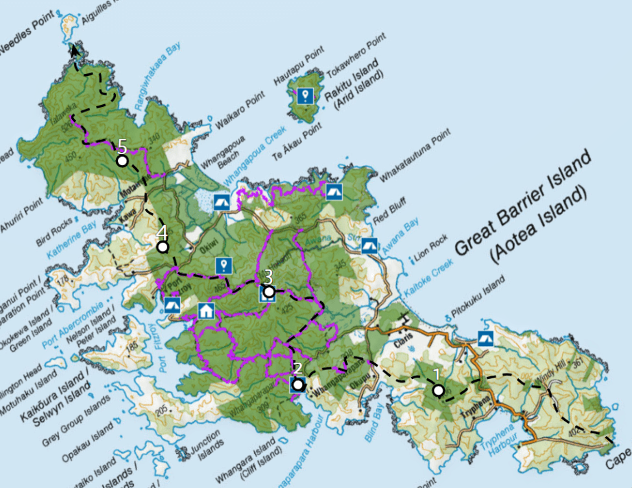
Planned Route
Planning and Preparations
I wanted to go from the Southern point to the Northernmost point of the island, so I could take in as much of the island’s landscape as possible.
I wanted to do a mix of off-track bush bashing and on-track hiking, allowing me to discover untouched areas as well as trek through well-worn paths, such as the infamous Aotea Track. I planned to start at Whalers Lookout, which is the Southernmost point.
When deciding what gear to bring, I decided to take a topographic map I downloaded on my phone, using the landscape on the map to help me navigate. This was especially important for the Southern Half of the island.
I also got a lightweight tent, sleeping bag and a waterproof covering for my tent, in case the conditions became wet and humid. In addition, I packed enough clothes I could change into after each day, as well as extra layers for cold nights, wet weather, as well as bringing sun protection such as a wide-brim hat.
For Food & Cooking, I decided to bring cold food instead of hot food to the tramp, as I wanted to carry less gear (a stove, fuel or cooking pot. This also meant I didn’t have to worry about running out of gas to heat up any food. I brought plenty of 1.5L plastic water bottles, and planned to refuel them at streams available. In case things did go wrong, I was given a personal locator beacon (PLB) and had emergency contacts like my mother to let her know if I’m safe.
Most importantly, I brought a power bank to recharge my phone every night to take pictures and look at my topo map, as well as a notebook to document things.
The Journey begins
I landed on Great Barrier Island in the afternoon of Feb 7th via a small plane at the Great Barrier Aerodrome. I managed to hitch a ride to go to my route start point, however, I wasn’t able to start the route at Whalers Lookout, so I had to start at Tryphena wharf and then go up towards my planned route through another track.
I continued along the ridgeline in the South and crossed Medland road, hiking until late in the evening and watching the sunset. I decided to stop for the night and set my tent up.
I got up around 10:00 am to bushbash 5km of dense bush. I underestimated how long this would take, being unfamiliar with the dense vegetation of Great Barrier Island. Pushing through dense foliage from the morning to late evening, I only managed to cover 3-4 km and was far away from my second stop at The Green Campsite when I decided to set my tent up once sunset occurred.
To make up for this, I woke up at 5:00 AM to rush through the rest of the dense vegetation, managing to reach a road and walking to the entrance of Te Ahumata Track 4-5 hours later. Taking a quick break, I hiked across the Track and then took a road to take a track to Green Campsite, reaching it in the early afternoon.
Having a quick lunch stop, I went to trek around 5-6 hours to Mt Hobson along the Aotea Track, which was a mix of steep ascents, deep forests, and windswept ridgelines. Climbing toward my third stop was Mt Heale Hut, at which the track was growing tougher and tougher as I became more physically exhausted.
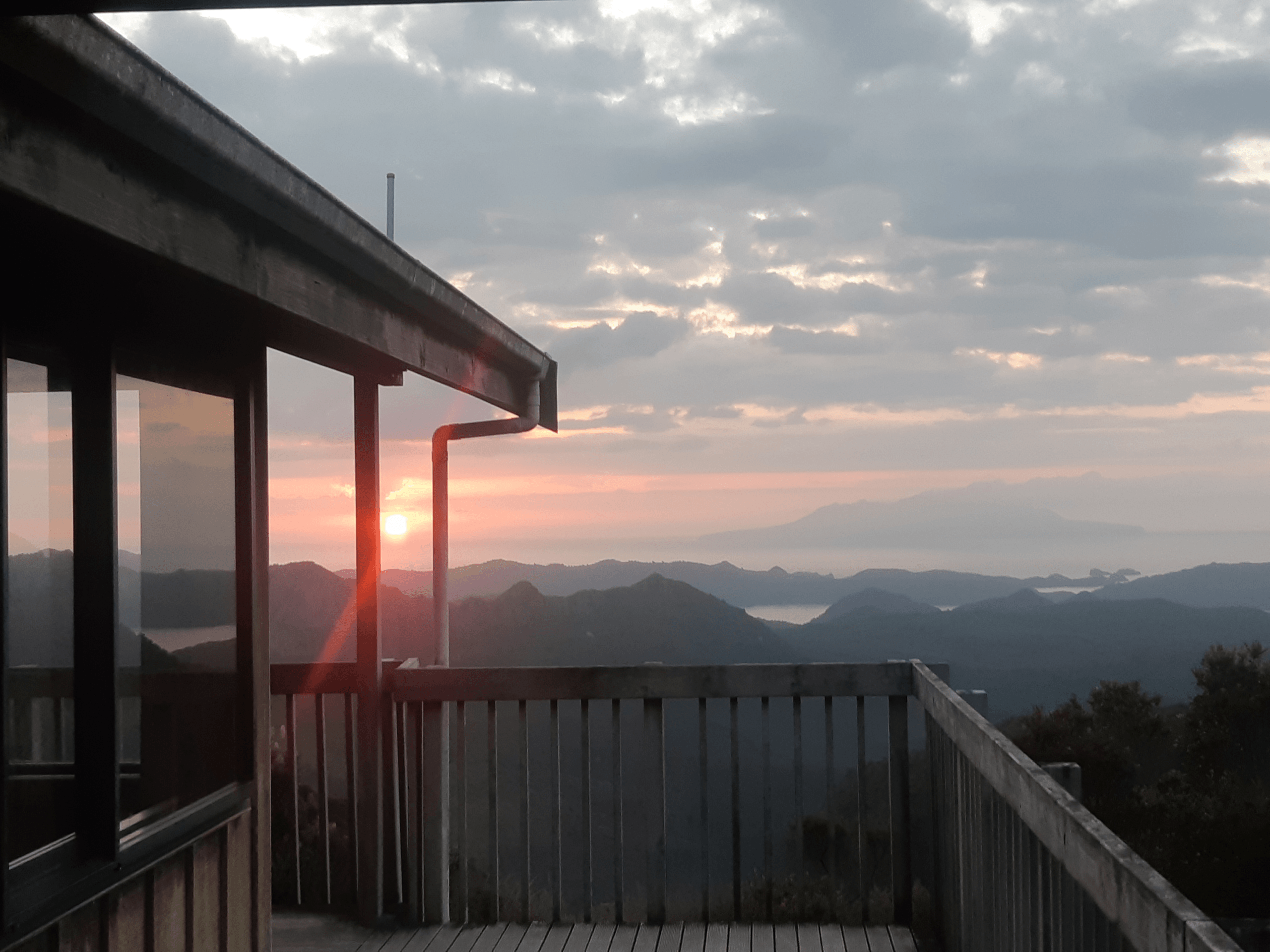
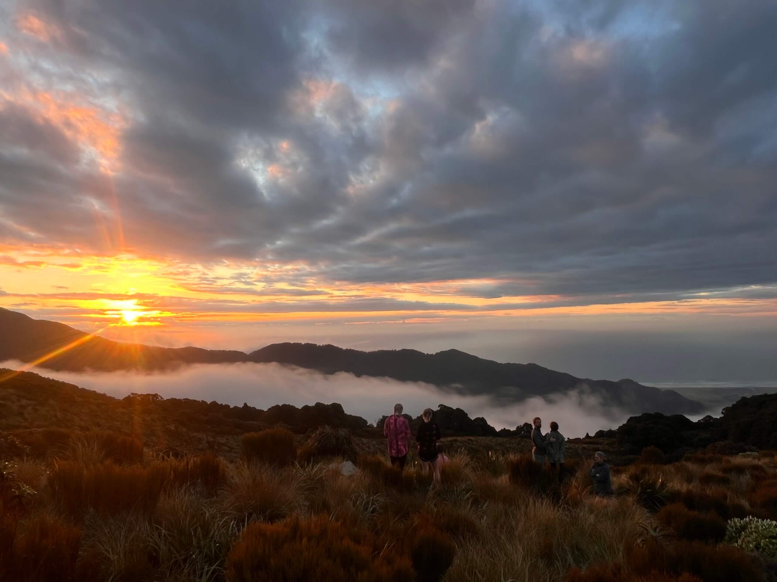
Sunset from Mt Heale Hut
However, I managed to reach Mt Heale Hut around 8:00 PM after a long day, with an awe-inspiring view of a bright orange sunset, reminding me why my long struggle that day was worth every second.
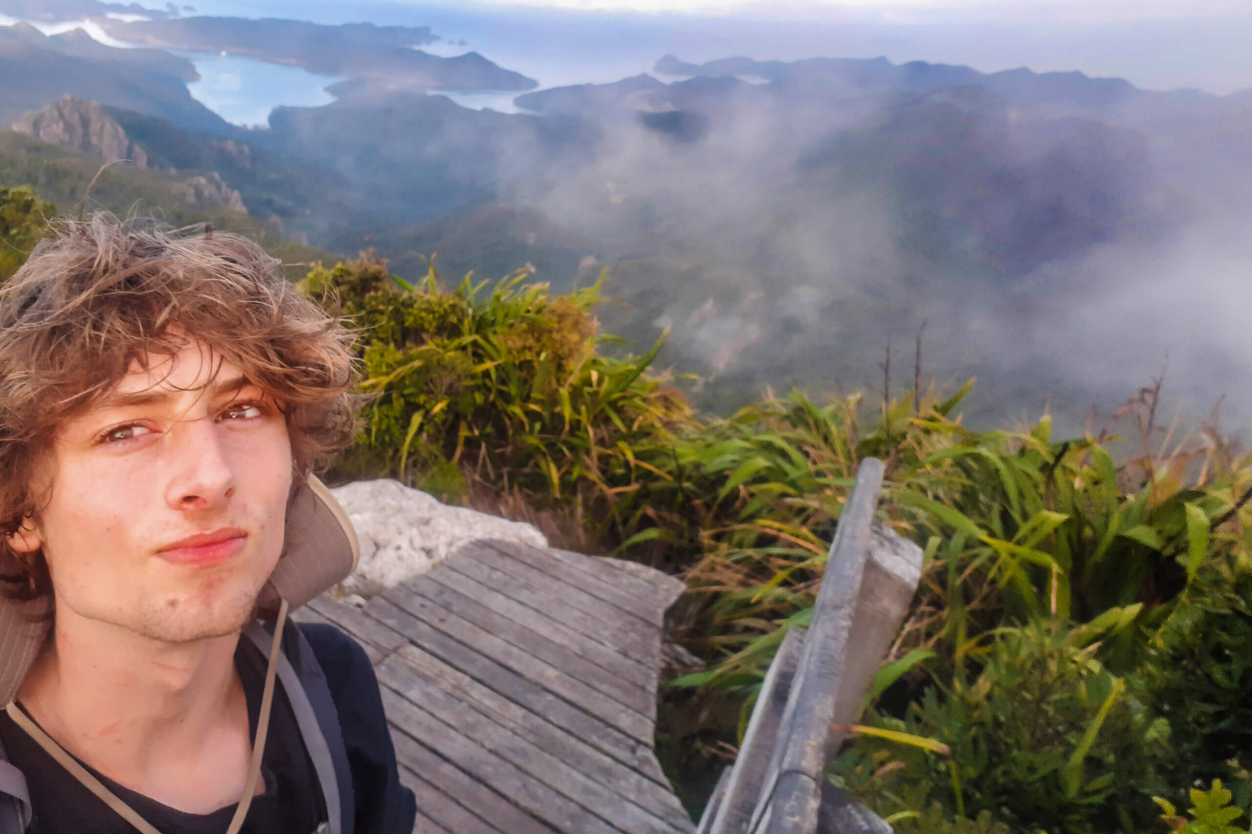
Falling fast asleep at Mt Heale Hut, I then woke up early to trek up towards Mt Hobson, capturing one of the best views I’ve ever witnessed, taking in the beautiful landscape of Great Barrier.
Once experiencing the great Mt Hobson, I walked down to take Kaiaraara Track to a junction I planned to pass through, however, the track was closed, and I had to take the alternative South Fork route, where I visited Kaiaraara Hut along the way. I took a coastal walk around Kaiarara Bay and Rarohara Bay.
I passed through Port Fitzroy and walked up Aotea Road, where I finally got to the junction I was supposed to get to using the Kaiaraara Track. I then went up Karaka Bay Rd and promptly hopped back into bush bashing, walking along the slopes close to Mabey Road where I decided to stop once the sun was setting.
The next day I embarked up North close to Mabey Road where I then crossed over Motairehe Road, bushbashed up a hill towards Burhill Route, a steep track that takes you up to Tataweka, the highest mountain in the North. Still being around the late afternoon, I set up my tent near Burhill Route, which is only 8 km in distance from North to South.
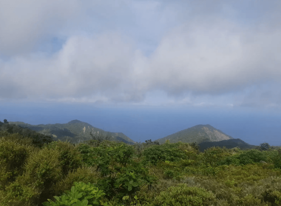
Northern Cliffs of Great Barrier Island, near Mt Tataweka
After my final night, I quickly hiked up the route and reached Tataweka, while meeting some DOC trappers along the way and finding some of the most stunning views on the Northern part of the island. It was finally over, and I managed to conquer the island.
Reflections & Lessons Learned
When reflecting on my trip, I think an important lesson I learnt is not to underestimate the route you’ll take, as I did not anticipate how intense the bush bashing would be. I would also plan further ahead and gain insight from people who have done the route before.
I gained a rekindled sense of adventure and exploration, stepping outside my comfort zone and doing an amazing trip of an underrated gem in New Zealand, while also gaining necessary experience.
We’re delighted to share another trip report from recent recipients of the FMC Expedition Scholarship. Applications close annually in mid-September. For more details on how to apply, please visit the FMC website at www.fmc.org.nz/