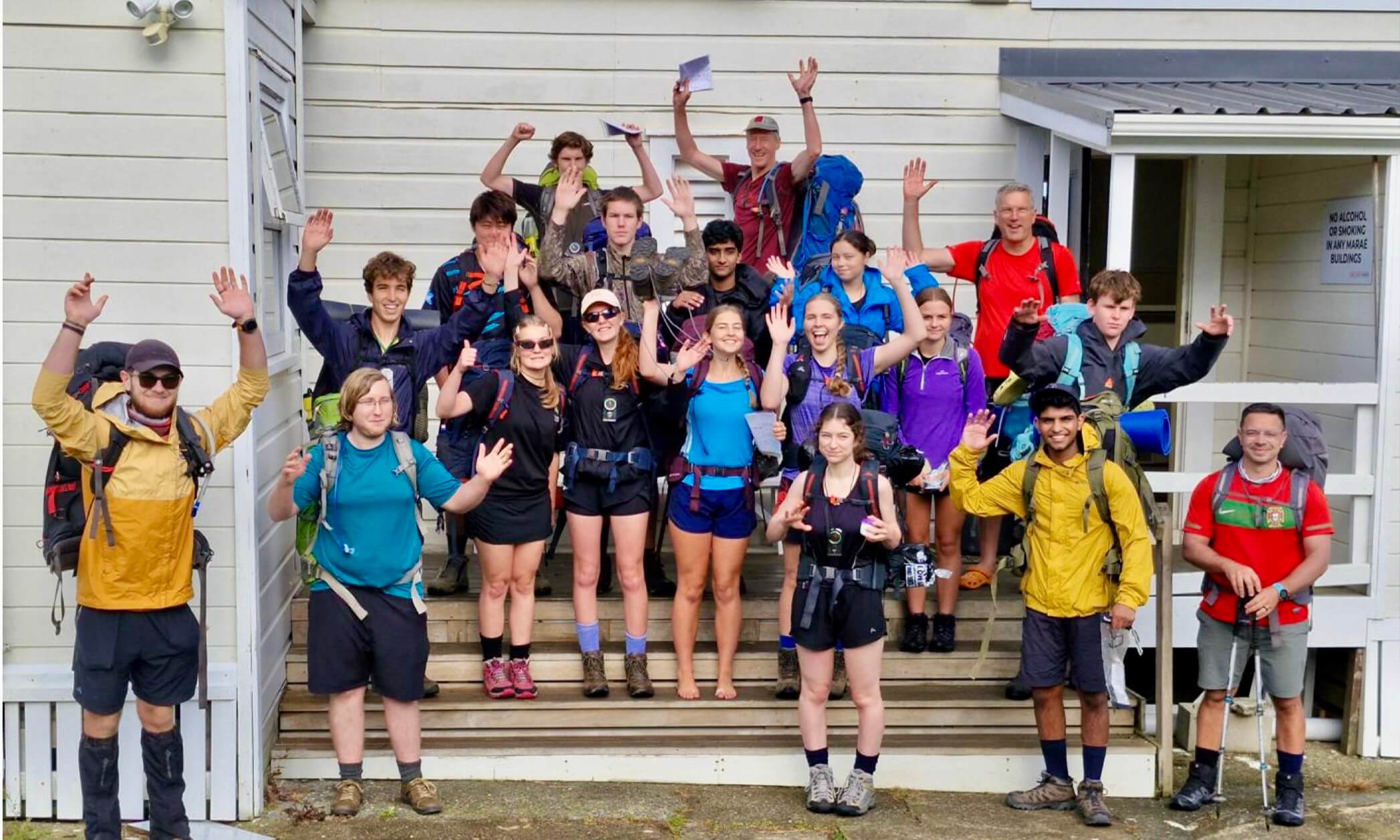
Moa Hunters on this trip: Richard, Chris, Magnus, Paul, Adam
Originally we planned to do the Rabbit Pass trip this year, but Mother Nature had other ideas. A very large landslide dammed the North branch of the Young River and created a substantial lake above it. The Department of Conservation, unsure of the stability of the dam, closed the Young Valley track, effectively buggering our prospects of doing the Young Valley, Gillespie Pass, Rabbit Pass walk. Undaunted, we came up with this itinerary instead:
Day 1: Start at the Routeburn Shelter over Sugarloaf Pass, descend into Rock Burn, camp at Theatre Flat.
Day 2: Theatre Flat to Park Pass and Lake Nerine.
Day 3: Lake Nerine to North Col, down to Routeburn North branch.
Day 4: Route Burn North branch to Routeburn Shelter.

Our route on topomap.co.nz

Our route on Google Maps
Google Earth flyover of the approximate Lake Nerine route
Day 1
Wednesday, 20th February 2008
ROUTEBURN SHELTER TO THEATRE FLAT

After a night on the floor of Sonya’s pad in Wanaka, we stood together at the start of the Routeburn track. Sonya had again gone above and beyond the call of duty – not only having driven us to the track, but also agreeing to collect us at the same spot a few days later. Somehow the bottles of spirits we give her never seem quite enough thanks for the amazing hospitality she shows us.

Moa Hunters at the Routeburn Shelter
Having “Great Walk” status brings a lot of foot traffic to the Routeburn Track … more than we were used to. The Routeburn shelter was fairly busy, so we wasted no time legging it down the track, keen to escape up the side track that would lead us to Sugarloaf Pass.
After an easy twenty minutes walk up the Routeburn, we found the inconspicuously signed side track. Chris noted that DOC are probably keen to keep it that way, to prevent inexperienced trampers accidentally wandering into more difficult terrain, away from the relative safety of the well-maintained Routeburn.
The side track climbed sharply and consistently and we were thankful for the short warmup on the Routeburn. It shouldn’t have been a surprise; after all, we were heading for a pass. The track ascended steadily through the beech forest. And so did we. Our first stop was in a small clearing just short of the snow line. The first uphill grunt of the trip deserved a reward, so we all tucked into our scroggin.

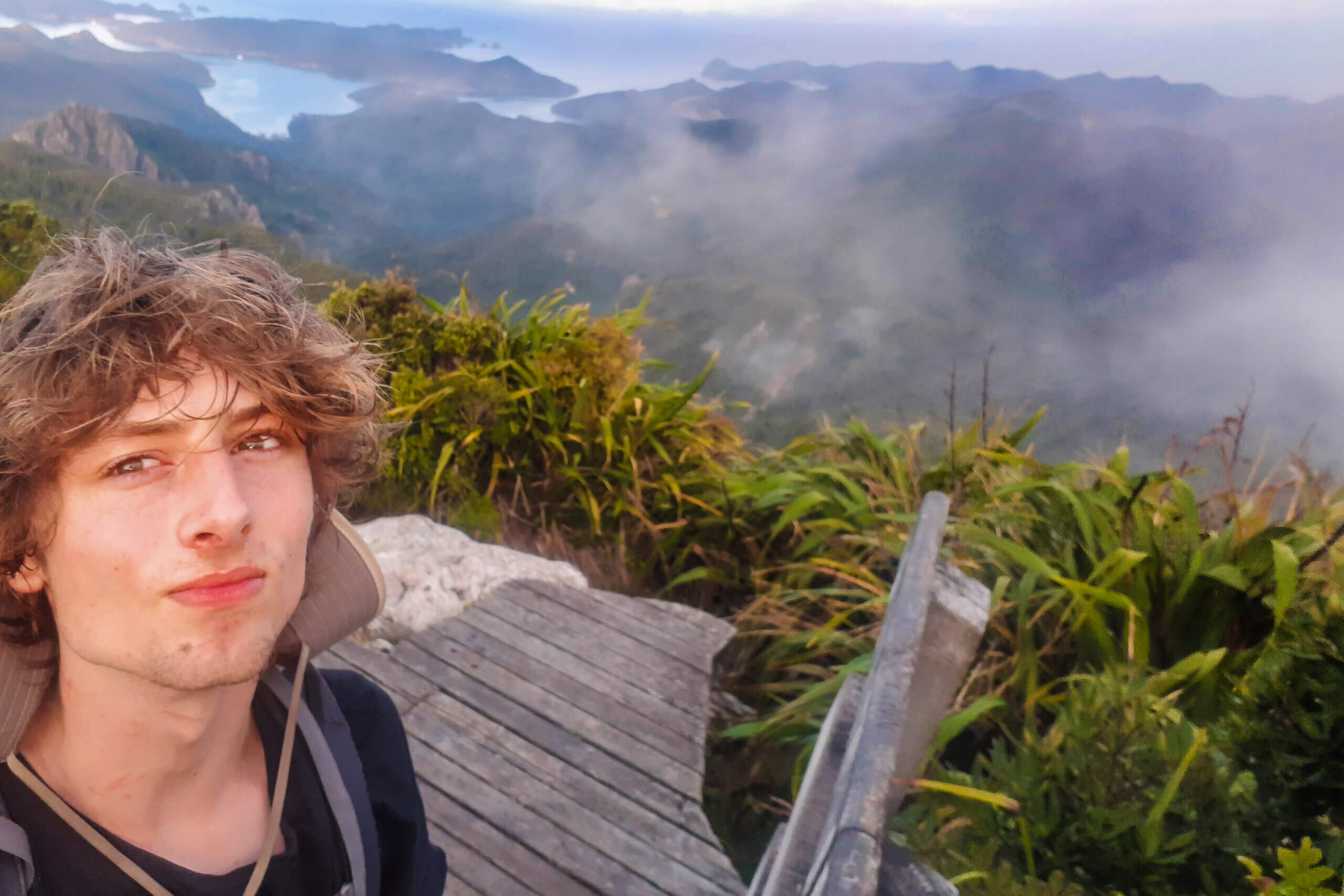
Huge views from Sugarloaf Pass
When we cleared the scrubby bush margins into open country, the view was stunning. Looking back towards Glenorchy and Lake Wakatipu, the sky was deep blue and the sheer scale of the vista totally breathtaking. Taking it all in, we all silently acknowledged that this was why we had come, and why we will keep putting heavy backpacks on for years to come.
The price of such amazing views was a lack of shelter from the sun. By the time we reached the pass, we were all melting and sweat was pouring off us. Knowing that below us there was a cool beech forest and some respite from the sun, we made quick progress downwards into the Rock Burn valley.

Richard contemplates the Rock Burn
For a short time, we enjoyed the relative cool shade of the bush before the track opened out into the more exposed river valley. We wandered for a couple of hours through the lush and occasionally boggy grasslands, eventually reaching a very wide open area – Theatre Flat.
While most of the flat wasn’t suitable for camping due to the tall clumps of tussock and sodden grass in between, we did eventually find a flat grassed area close to the river. We quickly pitched our two tents and brewed up a pretty damn good feed of curry mince on a gas cooker.

Paul and Chris model the latest in polypro fashion at Theatre Flat
Day 2
Thursday, 21st February 2008
THEATRE FLAT TO LAKE NERINE

Fortunately, the night wasn’t dewy and the next morning we were able to put dry gear and tents into our packs. With our bellies full of porridge (and brown sugar!), we set out for Park Pass. Our day would consist of a fairly solid climb up to the Pass, then an almost 180 degree change of direction, doubling back at high altitude to Lake Nerine. The only gnarly section, according to the route guide, would be a sidle across a steep hillslope thick with snow grass. In wet or snowy conditions, the sidle can apparently be quite difficult.

Park Pass
Following a nicely maintained series of cairns, we made our way up the valley to Park Pass. Whenever we had the opportunity, we added another rock or two to the less conspicuous cairns. Trampers before us had marked the trail, and maintaining it for others continues a nice tradition. Having a cairn trail benefits all trampers as well as the natural environment. Trampers stick to a single path and get lost less often. Most importantly, they only trample a thin strip of what is sometimes rare and delicate native flora.

Alpine daisies
We probably worried about the sidle more than we needed to. While it was a steep hillside with plenty of snowgrass, the dry conditions made it a fairly straightforward section of the track. Finding secure places for each boot step wasn’t hard and we scampered across in no time.
Traversing a sharp rocky ridge, we steadily gained altitude. It took a little longer than we expected, but we did eventually crest a rise and found ourselves looking down at a the first of two large mountain tarns.

A large tarn near Lake Nerine
Being a bunch of boys, we naturally took our packs off and began skimming stones across the glassy surface. I’m sure my mother would have told me to stop it, immediately! “If everyone does that, there will be no tarn one day.” But we did it anyway – some of us maybe a little guiltily…

Ice near a mountain tarn
The walk from the tarn to Lake Nerine was memorable with its amazing views back down the valley to Theatre Flat, where we had camped that night. Seeing where you were and how far you have come is quite rewarding at the end of the day, especially when you are starting to feel a little weary.

Theatre Flat from Lake Nerine
Finding Lake Nerine was easy. Finding a way down to Lake Nerine was harder. Surrounded on all sides by steep rocky slopes, picking a safe route down took a little time.

Looking down on Lake Nerine
Some of us picked our way down, navigating over and between some very large rocks and boulders. Richard and Magnus walked further round the lake and found what was probably the correct way down, via a narrow mostly shingle chute.

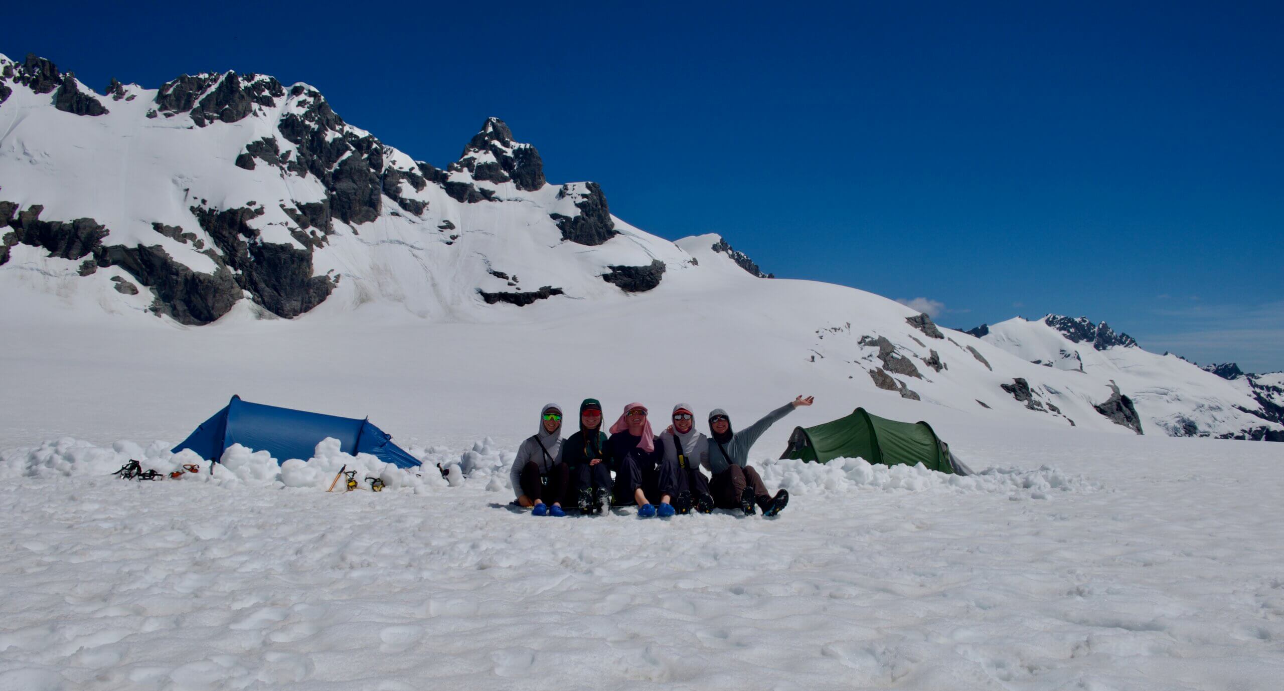
Surreal Lake Nerine
Lake Nerine is a surreal sort of place. With very little vegetation, some unusual rock formations and a bleak barrenness, it seems almost like a lunar landscape.
There is really only one place to camp at the lake – a small area of smooth ground with a low rock wall built around it to shelter tents from the prevailing wind. We setup camp in that spot and got busy cooking some food. Being at 1500 metres, the air temperature at the lake drops dramatically as the sun gets low. This effect is exaggerated by the high crags to the West which cut out the late afternoon sunshine. It wasn’t long before we had all pulled on a few extra layers of warm clothes.
Day 3
Friday, 22nd February 2008
LAKE NERINE TO ROUTEBURN NORTH BRANCH

After a very cool night, we arose to an equally chilly morning, with just a hint of ice on the tent flies. With a delicious feed of hot porridge on our bellies, we packed up camp and stood around pointing. Blokes like us tend to do that. Quite a lot. On this occasion, it was because we were discussing our exit plan from the lake. The guide we were using suggested climbing out via the southernmost notch in the western ridge which flanks the lake (the notches can be seen in the photo above). We were debating which one it might be.
It turns out we didn’t quite pick the most Southern one, and had to scramble over some extremely large rocks on the other side.

Giant rock hopping
From that point, our guide described traversing the slope and maintaining a 1500 metre altitude, which would take us directly to North Col.
What’s a col, you ask? Well it’s just a pass going by another name – the low point between two peaks.
For a few of us, this became a lesson in how easy it is to lose altitude during a long traverse. By the time we reached North Col, we had drifted some way down the hill, and had a fairly stiff and direct climb up to reach the col.
Loss of altitude can be a subtle and insidious thing. When approaching a large boulder or difficult piece of scrub, the natural tendency is to skirt around below it. Each time you do this, you drop a few metres down the hill. Over a long period, each small descent adds to the last and the total becomes significant. Hats off to Chris and Magnus, who had stuck firm to a much higher route and were at North Col ahead of us.
The top of North Col was a fantastic spot for a break. In particular the view down into Hidden Falls creek and across to Prospector Peak were quite dramatic. The other side of North Col was also more than pleasant – grassy and sheltered, with the odd alpine tarn.

A reflective tarn near North Col
The descent from North Col took us down a steepish valley into the upper catchment area of the Route Burn North Branch. The day was getting warmer, and by lunchtime we had descended into the sunny valley below. We found a very comfortable grassy slope to grab some lunch. Dragonflies buzzed about and we all felt very lazy. Lying back on the soft grass between tussocks, it was easy to doze off for a few minutes.
We did eventually wrench ourselves off the hill and proceeded down the track, which steadily leveled off into the grassy river valley of the Route Burn river.

Dropping down to the Route Burn
Finding a good spot for our tents proved a little bit challenging. The open expanses of the valley were mostly boggy and uneven. Ahead in the middle of the grassy flats, we spied what appeared to be an “island” of Manuka trees and bush which looked promising. It was clear we weren’t the first to think along those lines. On the river side of the elevated bush covered island was a clear grassy flat, which had obviously been used as a campsite many times before. We dumped our packs and put the tents up.
For this night Chris had an extra special culinary treat for us all. At Lake Nerine, he had quickly added some water and oil to a pre-prepared flour and yeast mix and kneaded it into a dough. This was placed into a billy, which was subsequently placed in a warm spot in his pack to rise throughout the day.
We gathered some dry twigs and branches and lit ourselves a cheerful bonfire in a spot often used for fires, judging by the blackened rocks there.

Smoke signals in the Routeburn Valley
This is when the magic began. Chris carefully divided the dough and shaped it into flat saucers. On a frypan over the bonfire, he proceeded to cook up a stunning naan bread selection. Scooping up mouthfuls of a more than slightly fiery curry mince on the naan bread was a satisfying end to an excellent day of walking. As dusk fell, a light drizzle that had been threatening for the last hour or two began to fall. We extinguished our fire and crawled into the tents.
Day 4
Saturday, 23rd February 2008
ROUTEBURN NORTH BRANCH TO ROAD END

The following morning dawned a little damp. We opted to pack up our gear and head somewhere drier for breakfast. Walking past the Routeburn Flats Hut, which looked extremely busy with people and tents dotted all about it, we eventually stopped under a large tree on the Routeburn track.
Richard had been carrying some interesting sounding freeze dried meals with him for the past few tramping trips, which he was keen to be rid of. He suggested we heat some for breakfast. Yummy. Freeze dried bacon and eggs, mixed with freeze dried beans, and some freeze dried other stuff. Allegedly macaroni cheese.

Mmm . . . Delicious freeze dried slops
We heated them together in a large billy, with Magnus standing to one side looking extremely skeptical. And justifiably so. Things turned rather pear shaped. The freeze dried food didn’t get enough time to rehydrate properly and mixing them together created an unholy looking bucket of slops. It tasted extremely bland. To cap it off, the beans remained firm on the outside, and dry and powdery inside. Like little dust bombs. We had somehow managed to follow-up one of the most triumphant tramping meals ever with possibly the most disastrous ever. It was hard to eat not only because it was so terrible, but also because we were all laughing so much.
From our breakfast tree, the walk to the Routeburn Shelter was a short one. We made it to the road and were picked up by Sonya who drove us back to Wanaka. We hadn’t showered for days and she uttered not one word of judgment. What a gal.
Later at Sonya’s house, Paul mentioned to her just how dry parts of the track seemed with all the recent hot weather. Sonya agreed, noting that there was a complete fire ban in place for Mt Aspiring National Park. “You didn’t light any fires, did you?” she asked. We exchanged glances. “Err, no. Of course not…” *gulp*
This article is written by the Moa Hunters, a group of simple blokes with a simple goal: find a moa.
“Every year, we fearlessly venture somewhere near the back of beyond in search of elusive moa. Our preferred hunting grounds to date have all been alpine areas in the South Island of New Zealand. We figure that a smart moa choosing somewhere to hide would go somewhere with a spectacular view. So far, we haven’t found one. Until we find a moa, we keep walking…”
FMC thanks the Moa Hunters for their permission to reproduce this article, first published on ‘The Moa Hunters’ in 2008.